
16044 Del Pino Dr La Pine, OR 97739
1.1
Acres
$36,364
Price per Acre
47,916
Sq Ft Lot
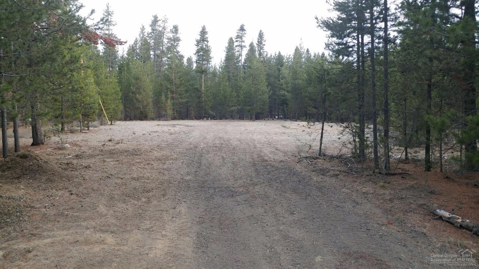
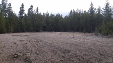
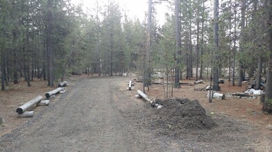
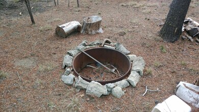
About This Lot
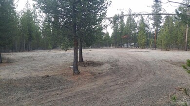
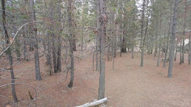
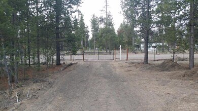
As of April 2025Beautiful treed lot cleared and fenced ready for your new home!
Last Agent to Sell the Property
Heidi Spiker
Fred Real Estate Group License #201219712
Last Buyer's Agent
Heidi Spiker
Fred Real Estate Group License #201219712
Property Details
Property Type
- Land
Est. Annual Taxes
- $171
Year Built
- 2018
Lot Details
- 1.1 Acre Lot
- Dirt Road
- Property is zoned RR10, WA, RR10, WA
Schools
- Lapine Elementary School
- Lapine Middle School
- Lapine Sr High School
Community Details
- No Home Owners Association
- Los Pinos Subdivision
Listing and Financial Details
- Legal Lot and Block 5 / 1
- Assessor Parcel Number 140095
Map
Create a Home Valuation Report for This Property
The Home Valuation Report is an in-depth analysis detailing your home's value as well as a comparison with similar homes in the area
Home Values in the Area
Average Home Value in this Area
Property History
| Date | Event | Price | Change | Sq Ft Price |
|---|---|---|---|---|
| 04/24/2025 04/24/25 | Sold | $510,000 | -2.9% | $343 / Sq Ft |
| 03/27/2025 03/27/25 | Pending | -- | -- | -- |
| 02/13/2025 02/13/25 | For Sale | $525,000 | +81.0% | $354 / Sq Ft |
| 12/26/2018 12/26/18 | Sold | $290,000 | -6.5% | $195 / Sq Ft |
| 12/10/2018 12/10/18 | Pending | -- | -- | -- |
| 09/19/2018 09/19/18 | For Sale | $310,000 | +675.0% | $209 / Sq Ft |
| 01/15/2018 01/15/18 | Sold | $40,000 | -27.1% | -- |
| 01/08/2018 01/08/18 | Pending | -- | -- | -- |
| 03/17/2017 03/17/17 | For Sale | $54,900 | -- | -- |
Source: Southern Oregon MLS
Tax History
| Year | Tax Paid | Tax Assessment Tax Assessment Total Assessment is a certain percentage of the fair market value that is determined by local assessors to be the total taxable value of land and additions on the property. | Land | Improvement |
|---|---|---|---|---|
| 2024 | $2,336 | $173,240 | -- | -- |
| 2023 | $2,284 | $168,200 | $0 | $0 |
| 2022 | $2,031 | $158,560 | $0 | $0 |
| 2021 | $2,044 | $153,950 | $0 | $0 |
| 2020 | $1,938 | $153,950 | $0 | $0 |
| 2019 | $1,949 | $127,410 | $0 | $0 |
| 2018 | $184 | $13,340 | $0 | $0 |
| 2017 | $180 | $12,960 | $0 | $0 |
| 2016 | $171 | $12,590 | $0 | $0 |
| 2015 | $167 | $12,230 | $0 | $0 |
| 2014 | $162 | $11,880 | $0 | $0 |
Source: Public Records
Mortgage History
| Date | Status | Loan Amount | Loan Type |
|---|---|---|---|
| Open | $79,000 | New Conventional | |
| Closed | $75,000 | Credit Line Revolving |
Source: Public Records
Deed History
| Date | Type | Sale Price | Title Company |
|---|---|---|---|
| Warranty Deed | $290,000 | First American Title | |
| Warranty Deed | $40,000 | Amerititle |
Source: Public Records
Similar Property in La Pine, OR
Source: Southern Oregon MLS
MLS Number: 201701732
APN: 140095
Disclaimer: Certain information contained herein is derived from information provided by parties other than Homes.com. All information provided is deemed reliable, but is not guaranteed to be accurate and should be independently verified.
![]() © 2025 Oregon Datashare (KCAR | MLSCO | SOMLS). All rights reserved. The data relating to real estate for sale on this web site comes in part from the Internet Data Exchange Program of the Oregon Datashare. Real estate listings held by IDX Brokerage firms other than Ten-X are marked with the Internet Data Exchange logo or the Internet Data Exchange thumbnail logo and detailed information about them includes the name of the listing Brokers. Information provided is for consumers' personal, non-commercial use and may not be used for any purpose other than to identify prospective properties the viewer may be interested in purchasing. The consumer will not copy, retransmit nor redistribute any of the content from this website. Information provided is deemed reliable, but not guaranteed.
© 2025 Oregon Datashare (KCAR | MLSCO | SOMLS). All rights reserved. The data relating to real estate for sale on this web site comes in part from the Internet Data Exchange Program of the Oregon Datashare. Real estate listings held by IDX Brokerage firms other than Ten-X are marked with the Internet Data Exchange logo or the Internet Data Exchange thumbnail logo and detailed information about them includes the name of the listing Brokers. Information provided is for consumers' personal, non-commercial use and may not be used for any purpose other than to identify prospective properties the viewer may be interested in purchasing. The consumer will not copy, retransmit nor redistribute any of the content from this website. Information provided is deemed reliable, but not guaranteed.
Nearby Homes
- 53260 Deep Woods Rd
- 16044 Bull Bat Ln
- 15976 Livewood Ct
- 15989 Bull Bat Ln
- 16040 Bull Bat Ln
- 53065 Woodstock Dr Unit 12
- 16039 Falcon Ln
- 53356 Deep Woods Rd
- 53374 Eagle Ln
- 15879 Bushberry Ct
- 53349 Woodstock Dr
- 15867 Bushberry Ct
- 15804 Sunrise Blvd
- 15810 Green Forest Rd
- 16033 Alpine Dr
- 53018 Tarry Ln
- 53005 Tarry Ln
- 15815 Dawn Rd
- 15750 Eastwind Ct
- 16015 Dyke Rd