Estimated Value: $207,000 - $218,000
3
Beds
2
Baths
1,416
Sq Ft
$151/Sq Ft
Est. Value
About This Home
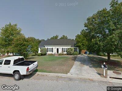
This home is located at 161 Elstow Rd, Irmo, SC 29063 and is currently estimated at $213,577, approximately $150 per square foot. 161 Elstow Rd is a home located in Richland County with nearby schools including H. E. Corley Elementary School, Dutch Fork Middle School, and Dutch Fork High School.
Ownership History
Date
Name
Owned For
Owner Type
Purchase Details
Closed on
Feb 25, 2025
Sold by
Kanoy Jacqueline L and Kanoy Paul J
Bought by
Lowe Larry and Lowe Lisa M
Current Estimated Value
Home Financials for this Owner
Home Financials are based on the most recent Mortgage that was taken out on this home.
Original Mortgage
$146,000
Outstanding Balance
$146,000
Interest Rate
6.93%
Mortgage Type
New Conventional
Estimated Equity
$72,419
Purchase Details
Closed on
Jun 20, 2013
Sold by
Kanoy Paul J and Kanoy Jacqueline L
Bought by
Kanoy Paul J and Kanoy Jacqueline A
Create a Home Valuation Report for This Property
The Home Valuation Report is an in-depth analysis detailing your home's value as well as a comparison with similar homes in the area
Home Values in the Area
Average Home Value in this Area
Purchase History
| Date | Buyer | Sale Price | Title Company |
|---|---|---|---|
| Lowe Larry | $210,000 | None Listed On Document | |
| Lowe Larry | $210,000 | None Listed On Document | |
| Kanoy Paul J | -- | None Available |
Source: Public Records
Mortgage History
| Date | Status | Borrower | Loan Amount |
|---|---|---|---|
| Open | Lowe Larry | $146,000 | |
| Closed | Lowe Larry | $146,000 | |
| Previous Owner | Kanoy Paul J | $15,000 | |
| Previous Owner | Kanoy Paul J | $62,000 |
Source: Public Records
Tax History Compared to Growth
Tax History
| Year | Tax Paid | Tax Assessment Tax Assessment Total Assessment is a certain percentage of the fair market value that is determined by local assessors to be the total taxable value of land and additions on the property. | Land | Improvement |
|---|---|---|---|---|
| 2023 | $1,101 | $3,892 | $0 | $0 |
| 2022 | $946 | $97,300 | $17,700 | $79,600 |
| 2021 | $965 | $3,890 | $0 | $0 |
| 2020 | $976 | $3,890 | $0 | $0 |
| 2019 | $985 | $3,890 | $0 | $0 |
| 2018 | $791 | $3,380 | $0 | $0 |
| 2017 | $731 | $3,380 | $0 | $0 |
| 2016 | $707 | $3,380 | $0 | $0 |
| 2015 | $708 | $3,380 | $0 | $0 |
| 2014 | $2,226 | $84,600 | $0 | $0 |
| 2013 | -- | $3,380 | $0 | $0 |
Source: Public Records
Map
Nearby Homes
- 548 Kenton Dr
- 136 Milway Rd
- 504 Kenton Dr
- 0 Broad River Rd Unit 597989
- 416 London Pride Rd
- 680 Cornerstone Cir
- Lot A-1 Broad River Rd
- Lot A-2 Broad River Rd
- 930 Chadford Rd
- 212 Shawn Ct
- 200 Boulters Lock Rd
- 10201 Broad River Rd
- 419 N Royal Tower Dr
- 213 N Royal Tower Dr
- 113 Western Ln
- 155 Minehead Rd
- 113 W Royal Tower Dr
- 149 Twisted Hill Rd
- 457 Kingshead Ct
- 513 Friarsgate Blvd