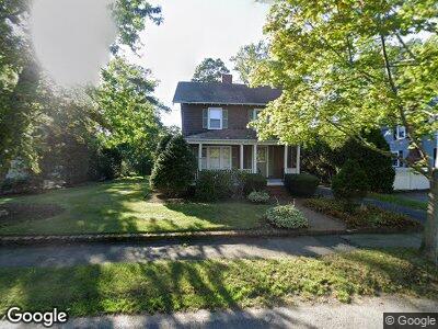
161 Melrose Ave Needham, MA 02492
Estimated Value: $2,310,000 - $3,315,000
6
Beds
7
Baths
5,900
Sq Ft
$494/Sq Ft
Est. Value
About This Home
This home is located at 161 Melrose Ave, Needham, MA 02492 and is currently estimated at $2,911,732, approximately $493 per square foot. 161 Melrose Ave is a home located in Norfolk County with nearby schools including Mitchell Elementary School, High Rock Middle School, and Pollard Middle School.
Ownership History
Date
Name
Owned For
Owner Type
Purchase Details
Closed on
Jan 3, 2025
Sold by
161 Melrose Llc
Bought by
Percival John and Percival Alyssa
Current Estimated Value
Home Financials for this Owner
Home Financials are based on the most recent Mortgage that was taken out on this home.
Original Mortgage
$2,462,625
Outstanding Balance
$2,456,340
Interest Rate
6.84%
Mortgage Type
Purchase Money Mortgage
Estimated Equity
$455,392
Create a Home Valuation Report for This Property
The Home Valuation Report is an in-depth analysis detailing your home's value as well as a comparison with similar homes in the area
Home Values in the Area
Average Home Value in this Area
Purchase History
| Date | Buyer | Sale Price | Title Company |
|---|---|---|---|
| Percival John | $3,283,500 | None Available | |
| Percival John | $3,283,500 | None Available |
Source: Public Records
Mortgage History
| Date | Status | Borrower | Loan Amount |
|---|---|---|---|
| Open | Percival John | $2,462,625 | |
| Closed | Percival John | $2,462,625 | |
| Previous Owner | 161 Melrose Llc | $2,205,800 | |
| Previous Owner | Loring Robert E | $75,500 |
Source: Public Records
Tax History Compared to Growth
Tax History
| Year | Tax Paid | Tax Assessment Tax Assessment Total Assessment is a certain percentage of the fair market value that is determined by local assessors to be the total taxable value of land and additions on the property. | Land | Improvement |
|---|---|---|---|---|
| 2025 | $8,960 | $845,300 | $791,200 | $54,100 |
| 2024 | $9,218 | $736,300 | $574,600 | $161,700 |
| 2023 | $9,446 | $724,400 | $574,600 | $149,800 |
| 2022 | $9,037 | $675,900 | $532,100 | $143,800 |
| 2021 | $8,807 | $675,900 | $532,100 | $143,800 |
| 2020 | $8,442 | $675,900 | $532,100 | $143,800 |
| 2019 | $7,729 | $623,800 | $483,700 | $140,100 |
| 2018 | $7,411 | $623,800 | $483,700 | $140,100 |
| 2017 | $7,239 | $608,800 | $483,700 | $125,100 |
| 2016 | $7,026 | $608,800 | $483,700 | $125,100 |
| 2015 | $6,873 | $608,800 | $483,700 | $125,100 |
| 2014 | $6,286 | $540,000 | $420,600 | $119,400 |
Source: Public Records
Map
Nearby Homes
- 22 Eaton Rd
- 63 Hawthorn Ave
- 31 Plymouth Rd
- 25 Bradford St
- 74 Page Rd
- 69 Plymouth Rd
- 81 Prince St
- 150 Fair Oaks Park
- 176 Highgate St
- 184 Brookline St
- 855 Great Plain Ave Unit 1
- 276 Dedham Ave
- 106 Dedham Ave
- 14 Shady Ln
- 18 Ina Rd
- 32 Lincoln St Unit 34
- 43 Highland Ct Unit 43
- 39 Donna Rd
- 62 Grant St
- 547 Webster St