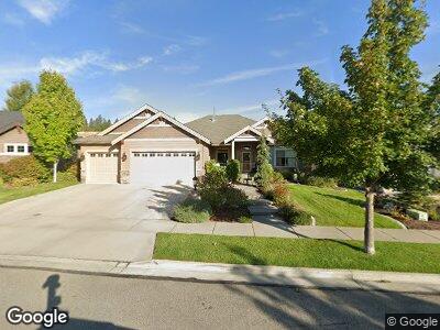
1613 N Sand Brook St Spokane, WA 99224
West Spokane NeighborhoodEstimated Value: $746,000 - $903,000
3
Beds
2
Baths
4,300
Sq Ft
$188/Sq Ft
Est. Value
About This Home
This home is located at 1613 N Sand Brook St, Spokane, WA 99224 and is currently estimated at $808,897, approximately $188 per square foot. 1613 N Sand Brook St is a home located in Spokane County with nearby schools including Hutton Elementary School, Sacajawea Middle School, and Lewis & Clark High School.
Ownership History
Date
Name
Owned For
Owner Type
Purchase Details
Closed on
Aug 31, 2010
Sold by
District 17 Community Colleges Foundatio
Bought by
Brodsky Justin R and Brodsky Mieko
Current Estimated Value
Home Financials for this Owner
Home Financials are based on the most recent Mortgage that was taken out on this home.
Original Mortgage
$273,500
Interest Rate
4.51%
Mortgage Type
New Conventional
Purchase Details
Closed on
Aug 20, 2009
Sold by
Fort Wright Llc
Bought by
District 17 Community Colleges Foundatio and Community Colleges Of Spokane Foundation
Create a Home Valuation Report for This Property
The Home Valuation Report is an in-depth analysis detailing your home's value as well as a comparison with similar homes in the area
Home Values in the Area
Average Home Value in this Area
Purchase History
| Date | Buyer | Sale Price | Title Company |
|---|---|---|---|
| Brodsky Justin R | $342,180 | Pacific Northwest Title | |
| District 17 Community Colleges Foundatio | $65,000 | Pacific Northwest Title |
Source: Public Records
Mortgage History
| Date | Status | Borrower | Loan Amount |
|---|---|---|---|
| Open | Brodsky Justin R | $50,000 | |
| Open | Brodsky Justin R | $228,500 | |
| Closed | Brodsky Justin R | $273,500 |
Source: Public Records
Tax History Compared to Growth
Tax History
| Year | Tax Paid | Tax Assessment Tax Assessment Total Assessment is a certain percentage of the fair market value that is determined by local assessors to be the total taxable value of land and additions on the property. | Land | Improvement |
|---|---|---|---|---|
| 2024 | $6,674 | $673,400 | $150,000 | $523,400 |
| 2023 | $7,052 | $726,600 | $140,000 | $586,600 |
| 2022 | $6,345 | $722,000 | $140,000 | $582,000 |
| 2021 | $6,119 | $515,200 | $53,000 | $462,200 |
| 2020 | $5,899 | $478,500 | $53,000 | $425,500 |
| 2019 | $5,034 | $421,500 | $53,000 | $368,500 |
| 2018 | $5,322 | $382,900 | $53,000 | $329,900 |
| 2017 | $4,819 | $353,100 | $53,000 | $300,100 |
| 2016 | $4,498 | $322,400 | $54,000 | $268,400 |
| 2015 | $4,517 | $316,800 | $54,000 | $262,800 |
| 2014 | -- | $307,400 | $48,000 | $259,400 |
| 2013 | -- | $0 | $0 | $0 |
Source: Public Records
Map
Nearby Homes
- 1115 N Inland St
- 3231 W Boone Ave Unit 921
- 3231 W Boone Ave Unit 118
- 1024 N Summit Blvd
- 6XX N Summit Blvd
- 2709 W Sinto Ave
- 3216 W Riverview Dr
- 3342 W Riverview Dr
- 2413 W Mission Ave
- 2414 W Sharp Ave
- 2330 W Maxwell Ave
- 2507 W Gardner Ave
- 2424 W Dean Ave Unit A
- 1747 N West Point Rd
- 3123 W Euclid Ave
- 2414 W Broadway Ave
- 2518 W Bridge Ave
- 2215 W Boone Ave
- 2209 W Boone Ave
- 605 N Cochran St