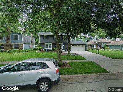
1620 Swallow St Naperville, IL 60565
Maple Brook NeighborhoodEstimated Value: $425,113 - $534,000
--
Bed
1
Bath
1,928
Sq Ft
$248/Sq Ft
Est. Value
About This Home
This home is located at 1620 Swallow St, Naperville, IL 60565 and is currently estimated at $478,778, approximately $248 per square foot. 1620 Swallow St is a home located in DuPage County with nearby schools including Maplebrook Elementary School, Lincoln Jr. High School, and Naperville Central High School.
Ownership History
Date
Name
Owned For
Owner Type
Purchase Details
Closed on
Jan 8, 2003
Sold by
Sirois Kent S
Bought by
Gowan Richard S and Gowan Julie M
Current Estimated Value
Home Financials for this Owner
Home Financials are based on the most recent Mortgage that was taken out on this home.
Original Mortgage
$204,000
Interest Rate
6.13%
Mortgage Type
Purchase Money Mortgage
Purchase Details
Closed on
Sep 14, 1998
Sold by
American National Bk & Tr Co Of Chicago
Bought by
Sirois Kent S
Create a Home Valuation Report for This Property
The Home Valuation Report is an in-depth analysis detailing your home's value as well as a comparison with similar homes in the area
Home Values in the Area
Average Home Value in this Area
Purchase History
| Date | Buyer | Sale Price | Title Company |
|---|---|---|---|
| Gowan Richard S | $255,000 | Law Title | |
| Sirois Kent S | $185,000 | First American Title |
Source: Public Records
Mortgage History
| Date | Status | Borrower | Loan Amount |
|---|---|---|---|
| Open | Gowan Richard S | $191,700 | |
| Closed | Gowan Richard S | $191,700 | |
| Closed | Gowan Richard S | $210,000 | |
| Closed | Gowan Richard S | $35,000 | |
| Closed | Gowan Richard S | $260,000 | |
| Closed | Gowan Richard S | $62,000 | |
| Closed | Gowan Richard S | $205,000 | |
| Closed | Gowan Richard S | $45,000 | |
| Closed | Gowan Richard S | $204,000 | |
| Closed | Gowan Richard S | $204,000 |
Source: Public Records
Tax History Compared to Growth
Tax History
| Year | Tax Paid | Tax Assessment Tax Assessment Total Assessment is a certain percentage of the fair market value that is determined by local assessors to be the total taxable value of land and additions on the property. | Land | Improvement |
|---|---|---|---|---|
| 2023 | $7,950 | $122,350 | $61,040 | $61,310 |
| 2022 | $7,541 | $116,520 | $58,130 | $58,390 |
| 2021 | $7,277 | $112,110 | $55,930 | $56,180 |
| 2020 | $7,127 | $110,090 | $54,920 | $55,170 |
| 2019 | $6,932 | $105,320 | $52,540 | $52,780 |
| 2018 | $6,765 | $102,750 | $51,260 | $51,490 |
| 2017 | $6,639 | $99,280 | $49,530 | $49,750 |
| 2016 | $6,518 | $95,690 | $47,740 | $47,950 |
| 2015 | $6,496 | $90,110 | $44,960 | $45,150 |
| 2014 | $6,388 | $85,820 | $42,820 | $43,000 |
| 2013 | $6,291 | $86,020 | $42,920 | $43,100 |
Source: Public Records
Map
Nearby Homes
- 1624 Bay Ct Unit 4
- 1677 Cove Ct Unit 1
- 124 E Bailey Rd Unit J
- 161 Pier Ct
- 138 E Bailey Rd Unit M
- 248 E Bailey Rd Unit L
- 208 E Bailey Rd Unit K
- 218 E Bailey Rd Unit A
- 218 E Bailey Rd Unit M
- 214 E Bailey Rd Unit J
- 254 E Bailey Rd Unit M
- 1533 Swallow St
- 1552 Lighthouse Dr
- 1503 Longbranch Ct Unit 3504D
- 1709 Napoleon Dr
- 443 Orleans Ave
- 1725 Amelia Ct
- 11 Foxcroft Rd Unit 115
- 633 Bourbon Ln
- 1550 Treeline Ct Unit 403