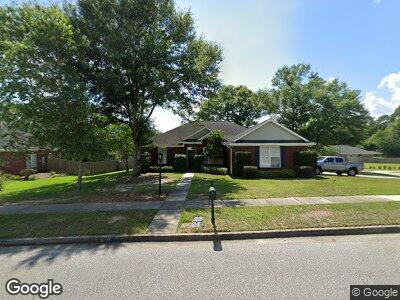
1628 Ashmoor Dr W Mobile, AL 36695
Second Creek NeighborhoodEstimated Value: $266,000 - $294,000
3
Beds
2
Baths
1,942
Sq Ft
$143/Sq Ft
Est. Value
About This Home
This home is located at 1628 Ashmoor Dr W, Mobile, AL 36695 and is currently estimated at $276,923, approximately $142 per square foot. 1628 Ashmoor Dr W is a home located in Mobile County with nearby schools including O'rourke Elementary School, Burns Middle School, and WP Davidson High School.
Ownership History
Date
Name
Owned For
Owner Type
Purchase Details
Closed on
Jul 26, 2024
Sold by
Beatty John W and Beatty Anne G
Bought by
Palmer Preston and Warren Sarah Denbow
Current Estimated Value
Home Financials for this Owner
Home Financials are based on the most recent Mortgage that was taken out on this home.
Original Mortgage
$175,000
Outstanding Balance
$174,118
Interest Rate
6.95%
Mortgage Type
New Conventional
Estimated Equity
$96,449
Purchase Details
Closed on
Oct 17, 2003
Sold by
Jbl Properties Ltd
Bought by
Beatty John W and Beatty Anne G
Home Financials for this Owner
Home Financials are based on the most recent Mortgage that was taken out on this home.
Original Mortgage
$115,900
Interest Rate
6.45%
Mortgage Type
Unknown
Create a Home Valuation Report for This Property
The Home Valuation Report is an in-depth analysis detailing your home's value as well as a comparison with similar homes in the area
Home Values in the Area
Average Home Value in this Area
Purchase History
| Date | Buyer | Sale Price | Title Company |
|---|---|---|---|
| Palmer Preston | $275,000 | Delta South Title Inc | |
| Beatty John W | -- | -- |
Source: Public Records
Mortgage History
| Date | Status | Borrower | Loan Amount |
|---|---|---|---|
| Open | Palmer Preston | $175,000 | |
| Previous Owner | Beatty John W | $115,900 | |
| Closed | Beatty John W | $42,077 |
Source: Public Records
Tax History Compared to Growth
Tax History
| Year | Tax Paid | Tax Assessment Tax Assessment Total Assessment is a certain percentage of the fair market value that is determined by local assessors to be the total taxable value of land and additions on the property. | Land | Improvement |
|---|---|---|---|---|
| 2024 | $994 | $21,670 | $4,500 | $17,170 |
| 2023 | $994 | $22,260 | $4,600 | $17,660 |
| 2022 | $1,023 | $22,480 | $4,600 | $17,880 |
| 2021 | $823 | $18,360 | $4,000 | $14,360 |
| 2020 | $840 | $18,690 | $4,000 | $14,690 |
| 2019 | $822 | $18,340 | $0 | $0 |
| 2018 | $830 | $18,500 | $0 | $0 |
| 2017 | $830 | $18,500 | $0 | $0 |
| 2016 | $828 | $18,460 | $0 | $0 |
| 2013 | $888 | $18,980 | $0 | $0 |
Source: Public Records
Map
Nearby Homes
- 1735 Ashmoor Dr W
- 7261 Grelot Rd
- 7180 Charlanda Blvd
- 7361 Carson Rd S
- 7331 Hawkins Manor N
- 1603 Stone Hedge Dr W
- 1333 Blue Ridge Cir
- 1920 Bradshire Dr
- 1905 Ridgeline Dr
- 1940 Bradshire Dr
- 1337 Carson Rd W
- 7510 Ridgeline Ct W
- 0 Stone Hedge Dr Unit 3 365612
- 0 Stone Hedge Dr Unit 7425140
- 7691 Sweetgum Ct
- 7669 Berwick Ct
- 0 Creekwood Place Dr Unit 7544137
- 0 Creekwood Place Dr Unit 7443191
- 7310 Laurie Ct
- 7300 Laurie Ct