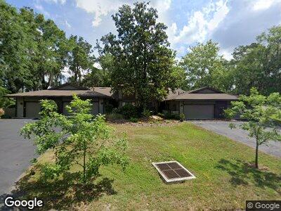
1630 NW 19th Cir Unit 3 Gainesville, FL 32605
Estimated Value: $284,245 - $358,000
4
Beds
3
Baths
2,624
Sq Ft
$124/Sq Ft
Est. Value
About This Home
This home is located at 1630 NW 19th Cir Unit 3, Gainesville, FL 32605 and is currently estimated at $324,561, approximately $123 per square foot. 1630 NW 19th Cir Unit 3 is a home located in Alachua County with nearby schools including Carolyn Beatrice Parker Elementary School, Westwood Middle School, and Gainesville High School.
Ownership History
Date
Name
Owned For
Owner Type
Purchase Details
Closed on
Jun 21, 2005
Sold by
Campen Dixie K
Bought by
Crockett Jean B
Current Estimated Value
Home Financials for this Owner
Home Financials are based on the most recent Mortgage that was taken out on this home.
Original Mortgage
$170,500
Interest Rate
5.25%
Mortgage Type
New Conventional
Purchase Details
Closed on
Nov 17, 1989
Bought by
Crockett Jean B
Purchase Details
Closed on
Oct 1, 1985
Bought by
Crockett Jean B
Purchase Details
Closed on
Aug 1, 1983
Bought by
Crockett Jean B
Create a Home Valuation Report for This Property
The Home Valuation Report is an in-depth analysis detailing your home's value as well as a comparison with similar homes in the area
Home Values in the Area
Average Home Value in this Area
Purchase History
| Date | Buyer | Sale Price | Title Company |
|---|---|---|---|
| Crockett Jean B | $220,500 | -- | |
| Crockett Jean B | $88,500 | -- | |
| Crockett Jean B | $87,000 | -- | |
| Crockett Jean B | $98,900 | -- |
Source: Public Records
Mortgage History
| Date | Status | Borrower | Loan Amount |
|---|---|---|---|
| Open | Crockett Jean B | $114,400 | |
| Closed | Crockett Jean B | $144,950 | |
| Closed | Crockett Jean B | $149,096 | |
| Closed | Crockett Jean B | $151,733 | |
| Closed | Crockett Jean B | $153,535 | |
| Closed | Crockett Jean B | $30,400 | |
| Closed | Crockett Jean B | $170,500 | |
| Previous Owner | Campen Dixie K | $133,300 |
Source: Public Records
Tax History Compared to Growth
Tax History
| Year | Tax Paid | Tax Assessment Tax Assessment Total Assessment is a certain percentage of the fair market value that is determined by local assessors to be the total taxable value of land and additions on the property. | Land | Improvement |
|---|---|---|---|---|
| 2024 | $1,856 | $118,288 | -- | -- |
| 2023 | $1,856 | $114,843 | $0 | $0 |
| 2022 | $1,665 | $111,498 | $0 | $0 |
| 2021 | $1,635 | $108,251 | $0 | $0 |
| 2020 | $1,601 | $106,756 | $0 | $0 |
| 2019 | $1,587 | $104,356 | $0 | $0 |
| 2018 | $1,462 | $102,410 | $0 | $0 |
| 2017 | $1,455 | $100,310 | $0 | $0 |
| 2016 | $1,422 | $98,250 | $0 | $0 |
| 2015 | $1,440 | $97,570 | $0 | $0 |
| 2014 | $1,435 | $96,800 | $0 | $0 |
| 2013 | -- | $98,400 | $17,000 | $81,400 |
Source: Public Records
Map
Nearby Homes
- 1648 NW 19th Cir
- 1654 NW 19th Cir
- 1706 NW 17th Ln
- 1719 NW 23rd Ave Unit 1B
- 1719 NW 23rd Ave Unit 3C
- 1719 NW 23rd Ave Unit 4A
- 1719 NW 23rd Ave Unit PH-A
- 1717 NW 23rd Ave Unit 4D
- 1717 NW 23rd Ave Unit PH A
- 1503 NW 17th Terrace
- 2265 NW 16th Terrace
- 2285 NW 16th Terrace
- 2110 NW 20th Terrace
- 1723 NW 14th Ave
- 1810 NW 23rd Blvd Unit 203
- 1810 NW 23rd Blvd Unit 165
- 1810 NW 23rd Blvd Unit 108
- 1810 NW 23rd Blvd Unit 181
- 1810 NW 23rd Blvd Unit 125
- 1810 NW 23rd Blvd Unit 114