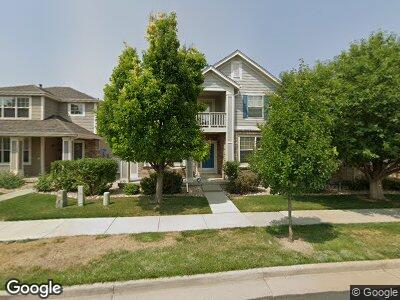
16477 E Auburn Hills Dr Parker, CO 80134
Bradbury Ranch NeighborhoodEstimated Value: $626,000 - $698,000
3
Beds
3
Baths
4,270
Sq Ft
$155/Sq Ft
Est. Value
About This Home
This home is located at 16477 E Auburn Hills Dr, Parker, CO 80134 and is currently estimated at $662,278, approximately $155 per square foot. 16477 E Auburn Hills Dr is a home located in Douglas County with nearby schools including Prairie Crossing Elementary School, Sierra Middle School, and Chaparral High School.
Ownership History
Date
Name
Owned For
Owner Type
Purchase Details
Closed on
Jan 28, 2016
Sold by
Sato Justin R and Sato Jami M
Bought by
Smith Ashley Morgan Stokes
Current Estimated Value
Home Financials for this Owner
Home Financials are based on the most recent Mortgage that was taken out on this home.
Original Mortgage
$313,600
Interest Rate
4.01%
Mortgage Type
New Conventional
Purchase Details
Closed on
Jun 18, 2004
Sold by
The Ryland Group Inc
Bought by
Sato Justin R and Sato Jami M
Home Financials for this Owner
Home Financials are based on the most recent Mortgage that was taken out on this home.
Original Mortgage
$271,500
Interest Rate
6.32%
Mortgage Type
Unknown
Create a Home Valuation Report for This Property
The Home Valuation Report is an in-depth analysis detailing your home's value as well as a comparison with similar homes in the area
Home Values in the Area
Average Home Value in this Area
Purchase History
| Date | Buyer | Sale Price | Title Company |
|---|---|---|---|
| Smith Ashley Morgan Stokes | $392,000 | Fidelity National Title | |
| Sato Justin R | $339,400 | Ryland Title Company |
Source: Public Records
Mortgage History
| Date | Status | Borrower | Loan Amount |
|---|---|---|---|
| Open | Stokes Smith Ashley Morgan | $218,800 | |
| Closed | Smith Ashley Morgan Stokes | $313,600 | |
| Previous Owner | Sato Justin R | $65,705 | |
| Previous Owner | Sato Justin R | $271,500 | |
| Closed | Sato Justin R | $45,400 |
Source: Public Records
Tax History Compared to Growth
Tax History
| Year | Tax Paid | Tax Assessment Tax Assessment Total Assessment is a certain percentage of the fair market value that is determined by local assessors to be the total taxable value of land and additions on the property. | Land | Improvement |
|---|---|---|---|---|
| 2024 | $3,494 | $43,680 | $7,790 | $35,890 |
| 2023 | $3,536 | $43,680 | $7,790 | $35,890 |
| 2022 | $2,962 | $34,260 | $5,420 | $28,840 |
| 2021 | $3,084 | $34,260 | $5,420 | $28,840 |
| 2020 | $3,000 | $33,890 | $6,050 | $27,840 |
| 2019 | $3,019 | $33,890 | $6,050 | $27,840 |
| 2018 | $2,818 | $30,840 | $5,420 | $25,420 |
| 2017 | $2,615 | $30,840 | $5,420 | $25,420 |
| 2016 | $2,292 | $26,530 | $5,010 | $21,520 |
| 2015 | $1,167 | $26,530 | $5,010 | $21,520 |
| 2014 | $2,418 | $24,510 | $5,010 | $19,500 |
Source: Public Records
Map
Nearby Homes
- 16367 E Auburn Hills Dr
- 11661 Night Heron Dr
- 11310 Night Heron Dr
- 16102 Grebe Place
- 11083 Quail Ct
- 16685 Trail Sky Cir
- 11072 Quail Ct
- 17031 E Cedar Gulch Dr
- 16333 Prairie Farm Cir
- 16523 High Desert Place
- 16434 Homestead Ct
- 17216 E Trailmaster Dr
- 16564 High Desert Way
- 10956 Osprey Ct
- 10965 Dearborne Dr
- 11008 Hayloft St
- 15920 Hayloft Ln
- 16355 Flintlock Ct
- 16149 Peregrine Dr
- 16025 Stringhalt Way