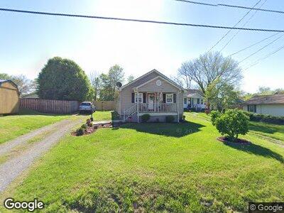
1648 Leaside Dr Kingsport, TN 37664
Estimated Value: $137,906 - $172,000
3
Beds
2
Baths
816
Sq Ft
$184/Sq Ft
Est. Value
About This Home
This home is located at 1648 Leaside Dr, Kingsport, TN 37664 and is currently estimated at $149,977, approximately $183 per square foot. 1648 Leaside Dr is a home located in Sullivan County with nearby schools including Thomas Jefferson Elementary School, Ross N. Robinson Middle School, and Dobyns-Bennett High School.
Ownership History
Date
Name
Owned For
Owner Type
Purchase Details
Closed on
Dec 11, 2018
Sold by
Fields Rodney G and Fields Vicky K
Bought by
Foreman Bradley and Fletcher Sarah
Current Estimated Value
Home Financials for this Owner
Home Financials are based on the most recent Mortgage that was taken out on this home.
Original Mortgage
$82,478
Outstanding Balance
$74,255
Interest Rate
5.37%
Mortgage Type
FHA
Estimated Equity
$74,692
Purchase Details
Closed on
May 31, 2011
Sold by
Fields Rodney G
Bought by
Fields Rodney G and Fields Paul Kenneth
Home Financials for this Owner
Home Financials are based on the most recent Mortgage that was taken out on this home.
Original Mortgage
$183,000
Interest Rate
4.71%
Mortgage Type
Commercial
Purchase Details
Closed on
Oct 25, 2005
Create a Home Valuation Report for This Property
The Home Valuation Report is an in-depth analysis detailing your home's value as well as a comparison with similar homes in the area
Home Values in the Area
Average Home Value in this Area
Purchase History
| Date | Buyer | Sale Price | Title Company |
|---|---|---|---|
| Foreman Bradley | $84,000 | Patriot Title Company | |
| Fields Rodney G | -- | -- | |
| -- | $18,000 | -- |
Source: Public Records
Mortgage History
| Date | Status | Borrower | Loan Amount |
|---|---|---|---|
| Open | Foreman Bradley | $82,478 | |
| Previous Owner | Fields Rodney Gale | $172,000 | |
| Previous Owner | Fields Rodney G | $183,000 | |
| Previous Owner | Fields Rodney G | $40,000 | |
| Previous Owner | Fields Rodney G | $18,742 |
Source: Public Records
Tax History Compared to Growth
Tax History
| Year | Tax Paid | Tax Assessment Tax Assessment Total Assessment is a certain percentage of the fair market value that is determined by local assessors to be the total taxable value of land and additions on the property. | Land | Improvement |
|---|---|---|---|---|
| 2024 | -- | $14,750 | $2,475 | $12,275 |
| 2023 | $650 | $14,750 | $2,475 | $12,275 |
| 2022 | $650 | $14,750 | $2,475 | $12,275 |
| 2021 | $632 | $14,750 | $2,475 | $12,275 |
| 2020 | $377 | $14,750 | $2,475 | $12,275 |
| 2019 | $680 | $14,675 | $2,475 | $12,200 |
| 2018 | $664 | $14,675 | $2,475 | $12,200 |
| 2017 | $664 | $14,675 | $2,475 | $12,200 |
| 2016 | $582 | $12,525 | $1,850 | $10,675 |
| 2014 | $548 | $12,523 | $0 | $0 |
Source: Public Records
Map
Nearby Homes
- 1652 Virginia Ave
- 3224 Clover St
- 1591 Kenmore Dr Unit B
- 2365 Ashwood Ave
- 2304 Ashwood Ave
- 3521 Memorial Blvd
- 1508 Warpath Dr
- 2312 E Center St
- 1461 Warpath Dr
- 2204 Maxwell Ave
- 1637 E St
- 1653 E St
- 1527 Fuller St
- 2020 E Center St
- 2108 Fort Henry Dr
- 3713 Bernard Cir
- 2479 Bridgeforth Crossing
- 1382 Farragut Ave
- 2904 Ashley St
- 4109 Bomitch Dr