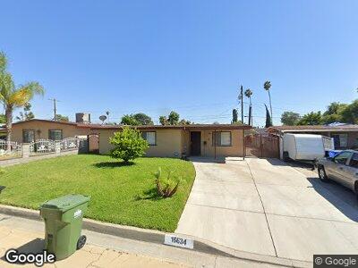
16634 E Brookport St Covina, CA 91722
Vincent NeighborhoodEstimated Value: $638,346 - $692,000
3
Beds
1
Bath
956
Sq Ft
$696/Sq Ft
Est. Value
About This Home
This home is located at 16634 E Brookport St, Covina, CA 91722 and is currently estimated at $665,337, approximately $695 per square foot. 16634 E Brookport St is a home located in Los Angeles County with nearby schools including Merwin Elementary School, Las Palmas Middle School, and Northview High School.
Ownership History
Date
Name
Owned For
Owner Type
Purchase Details
Closed on
Aug 12, 2024
Sold by
Pulido Juan S and Navarro Juanita
Bought by
Navarro Juanita
Current Estimated Value
Purchase Details
Closed on
Oct 6, 2021
Sold by
Pulido Juan S
Bought by
Pulido Juan S and Navarro Juanita
Home Financials for this Owner
Home Financials are based on the most recent Mortgage that was taken out on this home.
Original Mortgage
$159,900
Interest Rate
2.8%
Mortgage Type
New Conventional
Create a Home Valuation Report for This Property
The Home Valuation Report is an in-depth analysis detailing your home's value as well as a comparison with similar homes in the area
Home Values in the Area
Average Home Value in this Area
Purchase History
| Date | Buyer | Sale Price | Title Company |
|---|---|---|---|
| Navarro Juanita | -- | None Listed On Document | |
| Pulido Juan S | -- | Orange Coast Ttl Co Of Socal |
Source: Public Records
Mortgage History
| Date | Status | Borrower | Loan Amount |
|---|---|---|---|
| Previous Owner | Pulido Juan S | $159,900 | |
| Previous Owner | Pulido Juan S | $213,000 | |
| Previous Owner | Pulido Juan S | $203,500 | |
| Previous Owner | Pulido Juan S | $135,000 |
Source: Public Records
Tax History Compared to Growth
Tax History
| Year | Tax Paid | Tax Assessment Tax Assessment Total Assessment is a certain percentage of the fair market value that is determined by local assessors to be the total taxable value of land and additions on the property. | Land | Improvement |
|---|---|---|---|---|
| 2024 | $3,288 | $243,045 | $192,064 | $50,981 |
| 2023 | $3,237 | $238,281 | $188,299 | $49,982 |
| 2022 | $3,192 | $233,609 | $184,607 | $49,002 |
| 2021 | $3,141 | $229,030 | $180,988 | $48,042 |
| 2019 | $3,068 | $222,239 | $175,621 | $46,618 |
| 2018 | $2,903 | $217,882 | $172,178 | $45,704 |
| 2016 | $2,748 | $209,423 | $165,493 | $43,930 |
| 2015 | $2,673 | $206,279 | $163,008 | $43,271 |
| 2014 | $2,642 | $202,239 | $159,815 | $42,424 |
Source: Public Records
Map
Nearby Homes
- 4734 N Vincent Ave Unit A
- 4734 N Vincent Ave Unit B
- 4545 N Coney Ave
- 16828 E Benbow St
- 4503 N Vincent Ave
- 1188 W Masline St
- 4903 N Enid Ave
- 1157 W Greenhaven St
- 5147 N Saint Malo Ave
- 906 N Rimsdale Ave
- 5216 N Roxburgh Ave
- 1007 W Benwood St
- 16249 Arrow Hwy
- 1145 W Bridger St
- 1045 N Azusa Ave
- 1045 N Azusa Ave Unit 116
- 838 Lexi Ln
- 4209 N Shadydale Ave
- 876 W Griswold Rd
- 16719 E Renwick Rd