17 Beverly Park Beverly Hills, CA 90210
Beverly Crest NeighborhoodEstimated Value: $4,852,000 - $17,837,878
9
Beds
10
Baths
11,968
Sq Ft
$948/Sq Ft
Est. Value
About This Home
This home is located at 17 Beverly Park, Beverly Hills, CA 90210 and is currently estimated at $11,344,939, approximately $947 per square foot. 17 Beverly Park is a home located in Los Angeles County with nearby schools including Warner Avenue Elementary.
Ownership History
Date
Name
Owned For
Owner Type
Purchase Details
Closed on
Dec 17, 2002
Sold by
Rigney John and Atlanta Trust
Bought by
Jackson Samuel L
Current Estimated Value
Purchase Details
Closed on
Jun 14, 2000
Sold by
Big Buck Trust and Benjamin
Bought by
Rigney John and The Atlanta Trust
Home Financials for this Owner
Home Financials are based on the most recent Mortgage that was taken out on this home.
Original Mortgage
$5,000,000
Interest Rate
5.95%
Mortgage Type
Unknown
Purchase Details
Closed on
Apr 28, 1998
Sold by
Montellano Holdings Inc
Bought by
Segal Mark and The Big Buck Trust
Home Financials for this Owner
Home Financials are based on the most recent Mortgage that was taken out on this home.
Original Mortgage
$1,000,000
Interest Rate
7.06%
Mortgage Type
Unknown
Purchase Details
Closed on
Dec 28, 1994
Sold by
H M Holdings Inc
Bought by
Montellano Holdings Inc
Create a Home Valuation Report for This Property
The Home Valuation Report is an in-depth analysis detailing your home's value as well as a comparison with similar homes in the area
Home Values in the Area
Average Home Value in this Area
Purchase History
| Date | Buyer | Sale Price | Title Company |
|---|---|---|---|
| Jackson Samuel L | -- | -- | |
| Rigney John | -- | Southland Title Corporation | |
| Segal Mark | $7,500,000 | Chicago Title Co | |
| Montellano Holdings Inc | -- | -- |
Source: Public Records
Mortgage History
| Date | Status | Borrower | Loan Amount |
|---|---|---|---|
| Previous Owner | Rigney John | $5,000,000 | |
| Previous Owner | Thomas Benjamin | $1,000,000 | |
| Previous Owner | Segal Mark | $1,000,000 |
Source: Public Records
Tax History Compared to Growth
Tax History
| Year | Tax Paid | Tax Assessment Tax Assessment Total Assessment is a certain percentage of the fair market value that is determined by local assessors to be the total taxable value of land and additions on the property. | Land | Improvement |
|---|---|---|---|---|
| 2024 | $154,040 | $12,677,084 | $9,869,898 | $2,807,186 |
| 2023 | $150,719 | $12,403,845 | $9,676,371 | $2,727,474 |
| 2022 | $143,702 | $12,160,634 | $9,486,639 | $2,673,995 |
| 2021 | $141,981 | $11,922,191 | $9,300,627 | $2,621,564 |
| 2019 | $137,625 | $11,568,574 | $9,024,766 | $2,543,808 |
| 2018 | $136,754 | $11,341,740 | $8,847,810 | $2,493,930 |
| 2016 | $130,820 | $10,901,329 | $8,504,240 | $2,397,089 |
| 2015 | $128,884 | $10,737,582 | $8,376,499 | $2,361,083 |
| 2014 | $129,248 | $10,527,248 | $8,212,415 | $2,314,833 |
Source: Public Records
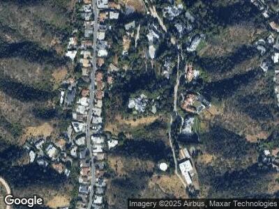
Map
Nearby Homes
- 1840 San Ysidro Dr
- 1937 N Beverly Dr
- 1839 N Beverly Dr
- 2208 San Ysidro Dr
- 1853 Franklin Canyon Dr
- 2226 San Ysidro Dr
- 1740 Summitridge Dr
- 1737 N Beverly Dr
- 1680 Summitridge Dr
- 1619 San Ysidro Dr
- 1665 Summitridge Dr
- 1648 Summitridge Dr
- 9662 Highridge Dr
- 1663 Summitridge Dr
- 1555 San Ysidro Dr
- 1625 Summitridge Dr
- 9626 Highridge Dr
- 1424 N Seabright Dr
- 1551 Summitridge Dr
- 1501 Tower Grove Dr