170 Sargent Rd Brookline, MA 02445
South Brookline NeighborhoodEstimated Value: $1,464,000 - $28,371,943
6
Beds
5
Baths
5,626
Sq Ft
$2,652/Sq Ft
Est. Value
About This Home
This home is located at 170 Sargent Rd, Brookline, MA 02445 and is currently estimated at $14,917,972, approximately $2,651 per square foot. 170 Sargent Rd is a home located in Norfolk County with nearby schools including Heath Elementary School, Brookline High School, and Maimonides School.
Ownership History
Date
Name
Owned For
Owner Type
Purchase Details
Closed on
Mar 11, 2009
Sold by
Summera Rt and Ley Andrew J
Bought by
Summera Llc
Current Estimated Value
Purchase Details
Closed on
Aug 22, 2007
Sold by
Mccourt Jamie D
Bought by
Summera Rt and Ley Andrew J
Create a Home Valuation Report for This Property
The Home Valuation Report is an in-depth analysis detailing your home's value as well as a comparison with similar homes in the area
Home Values in the Area
Average Home Value in this Area
Purchase History
| Date | Buyer | Sale Price | Title Company |
|---|---|---|---|
| Summera Llc | -- | -- | |
| Summera Rt | $16,000,000 | -- |
Source: Public Records
Mortgage History
| Date | Status | Borrower | Loan Amount |
|---|---|---|---|
| Previous Owner | Mccourt Jamie D | $9,999,999 |
Source: Public Records
Tax History Compared to Growth
Tax History
| Year | Tax Paid | Tax Assessment Tax Assessment Total Assessment is a certain percentage of the fair market value that is determined by local assessors to be the total taxable value of land and additions on the property. | Land | Improvement |
|---|---|---|---|---|
| 2025 | $13,084 | $1,325,600 | $1,325,600 | $0 |
| 2024 | $12,453 | $1,274,600 | $1,274,600 | $0 |
| 2023 | $10,932 | $1,096,500 | $1,096,500 | $0 |
| 2022 | $10,641 | $1,044,300 | $1,044,300 | $0 |
| 2021 | $9,840 | $1,004,100 | $1,004,100 | $0 |
| 2020 | $8,626 | $912,800 | $912,800 | $0 |
| 2019 | $8,146 | $869,400 | $869,400 | $0 |
| 2018 | $7,892 | $834,300 | $834,300 | $0 |
| 2017 | $7,777 | $787,100 | $787,100 | $0 |
| 2016 | $7,665 | $735,600 | $735,600 | $0 |
| 2015 | $7,343 | $687,500 | $687,500 | $0 |
| 2014 | $7,118 | $624,900 | $624,900 | $0 |
Source: Public Records
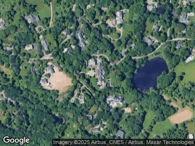
Map
Nearby Homes
- 100 Cottage St
- 235 Warren St
- 63 Goddard Ave
- 75 Goddard Ave
- 280 Warren St
- 241 Perkins St Unit C305
- 241 Perkins St Unit B302
- 241 Perkins St Unit C402
- 241 Perkins St Unit D605
- 22 Chestnut Place Unit 607
- 22 Chestnut Place Unit 307
- 22 Chestnut Place Unit 106
- 112 Franklin St Unit 3
- 469 Walnut St
- 423 Walnut St
- 331 Cypress St
- 371 Walnut St
- 80 Dudley St
- 125 Lee St
- 71 Sears Rd