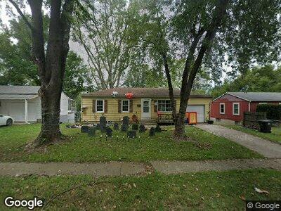
1704 S Trail Ridge Dr Independence, MO 64050
Queen City NeighborhoodEstimated Value: $137,000 - $212,000
3
Beds
2
Baths
888
Sq Ft
$190/Sq Ft
Est. Value
About This Home
This home is located at 1704 S Trail Ridge Dr, Independence, MO 64050 and is currently estimated at $168,281, approximately $189 per square foot. 1704 S Trail Ridge Dr is a home located in Jackson County with nearby schools including Glendale Elementary School, Bridger Middle School, and Bingham Middle School.
Ownership History
Date
Name
Owned For
Owner Type
Purchase Details
Closed on
May 20, 2009
Sold by
Aurora Loan Services
Bought by
Lee Liang Yeeng
Current Estimated Value
Purchase Details
Closed on
Mar 26, 2009
Sold by
Sickles Steven V
Bought by
Aurora Loan Services
Purchase Details
Closed on
Sep 6, 2005
Sold by
England Patricia Ann
Bought by
Sickles Steven V
Purchase Details
Closed on
Mar 4, 1997
Sold by
England Patricia Ann
Bought by
England Troy and Holler Tracy
Purchase Details
Closed on
Jul 31, 1996
Sold by
England Patricia Ann
Bought by
England Patricia Ann
Create a Home Valuation Report for This Property
The Home Valuation Report is an in-depth analysis detailing your home's value as well as a comparison with similar homes in the area
Home Values in the Area
Average Home Value in this Area
Purchase History
| Date | Buyer | Sale Price | Title Company |
|---|---|---|---|
| Lee Liang Yeeng | -- | Mokan Title Services Llc | |
| Aurora Loan Services | $101,193 | None Available | |
| Sickles Steven V | -- | Ctic | |
| England Troy | -- | -- | |
| England Patricia Ann | -- | -- | |
| England Patricia Ann | -- | -- |
Source: Public Records
Mortgage History
| Date | Status | Borrower | Loan Amount |
|---|---|---|---|
| Previous Owner | Sickles Steven | $92,000 |
Source: Public Records
Tax History Compared to Growth
Tax History
| Year | Tax Paid | Tax Assessment Tax Assessment Total Assessment is a certain percentage of the fair market value that is determined by local assessors to be the total taxable value of land and additions on the property. | Land | Improvement |
|---|---|---|---|---|
| 2024 | $1,566 | $23,133 | $2,808 | $20,325 |
| 2023 | $1,566 | $23,132 | $2,880 | $20,252 |
| 2022 | $1,179 | $15,960 | $3,245 | $12,715 |
| 2021 | $1,178 | $15,960 | $3,245 | $12,715 |
| 2020 | $1,150 | $15,130 | $3,245 | $11,885 |
| 2019 | $1,131 | $15,130 | $3,245 | $11,885 |
| 2018 | $1,031 | $13,167 | $2,824 | $10,343 |
| 2017 | $1,031 | $13,167 | $2,824 | $10,343 |
| 2016 | $1,016 | $12,838 | $2,544 | $10,294 |
| 2014 | $965 | $12,464 | $2,470 | $9,994 |
Source: Public Records
Map
Nearby Homes
- 16103 E 17th St S
- 1901 S Lee's Summit Rd
- 16404 E 16th St S
- 1909 S Ellison Way
- 15807 E 20th St S
- 2100 & 2105 S Ellison Way
- 15801 E 20th St S Unit A
- 1800 S M 291 Hwy
- 809 S Mills St
- 902 S Haden St
- 2725 S Queen Ridge Way
- 1413 E Pacific Ave
- 715 S Savage St
- 1002 S Haden St
- 1123 S Haden St
- 2311 Queen Ridge Dr
- 812 S Savage St
- 216 S Rogers St
- 16131 & 16133 E 23rd St
- 1134 S Haden St