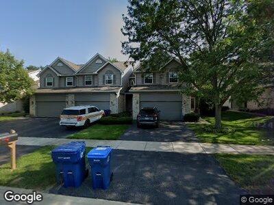
17097 W Cunningham Ct Unit 15B Libertyville, IL 60048
Estimated Value: $319,000 - $342,000
3
Beds
2
Baths
1,908
Sq Ft
$174/Sq Ft
Est. Value
About This Home
This home is located at 17097 W Cunningham Ct Unit 15B, Libertyville, IL 60048 and is currently estimated at $331,261, approximately $173 per square foot. 17097 W Cunningham Ct Unit 15B is a home located in Lake County with nearby schools including Woodland Primary School, Woodland Elementary School, and Woodland Intermediate School.
Ownership History
Date
Name
Owned For
Owner Type
Purchase Details
Closed on
May 5, 2005
Sold by
Root Craig R and Bodensteiner Root Kelly V
Bought by
Nebelski Rohan and Melnik Irina
Current Estimated Value
Home Financials for this Owner
Home Financials are based on the most recent Mortgage that was taken out on this home.
Original Mortgage
$212,000
Interest Rate
5.5%
Mortgage Type
Purchase Money Mortgage
Purchase Details
Closed on
Apr 7, 1999
Sold by
Parkway Bank & Trust Company
Bought by
Root Craig R and Bodenstiener Root Kelly V
Home Financials for this Owner
Home Financials are based on the most recent Mortgage that was taken out on this home.
Original Mortgage
$175,740
Interest Rate
7.05%
Mortgage Type
Purchase Money Mortgage
Create a Home Valuation Report for This Property
The Home Valuation Report is an in-depth analysis detailing your home's value as well as a comparison with similar homes in the area
Home Values in the Area
Average Home Value in this Area
Purchase History
| Date | Buyer | Sale Price | Title Company |
|---|---|---|---|
| Nebelski Rohan | $265,000 | Ticor Title Insurance Compan | |
| Root Craig R | $185,000 | Ticor Title |
Source: Public Records
Mortgage History
| Date | Status | Borrower | Loan Amount |
|---|---|---|---|
| Open | Melnik Irina | $180,000 | |
| Closed | Melnik Irina | $205,000 | |
| Closed | Nebelski Roman | $35,000 | |
| Previous Owner | Nebelski Rohan | $212,000 | |
| Previous Owner | Root Craig R | $160,900 | |
| Previous Owner | Root Craig R | $175,740 |
Source: Public Records
Tax History Compared to Growth
Tax History
| Year | Tax Paid | Tax Assessment Tax Assessment Total Assessment is a certain percentage of the fair market value that is determined by local assessors to be the total taxable value of land and additions on the property. | Land | Improvement |
|---|---|---|---|---|
| 2023 | $6,993 | $87,966 | $9,787 | $78,179 |
| 2022 | $6,993 | $76,440 | $10,764 | $65,676 |
| 2021 | $6,319 | $73,373 | $10,332 | $63,041 |
| 2020 | $6,074 | $71,569 | $10,078 | $61,491 |
| 2019 | $5,956 | $69,491 | $9,785 | $59,706 |
| 2018 | $6,187 | $73,861 | $4,862 | $68,999 |
| 2017 | $6,199 | $71,745 | $4,723 | $67,022 |
| 2016 | $6,172 | $68,551 | $4,513 | $64,038 |
| 2015 | $5,994 | $65,014 | $4,280 | $60,734 |
| 2014 | $6,842 | $73,737 | $4,223 | $69,514 |
| 2012 | $6,479 | $74,301 | $4,255 | $70,046 |
Source: Public Records
Map
Nearby Homes
- 33430 N Hunt Club Rd
- 6359 Doral Dr
- 6262 Eagle Ridge Dr
- 771 Darnell Ln Unit 2
- 33765 N Pine Creek Trail
- 17720 W Dartmoor Dr
- 17768 W Iroquois Dr
- 6135 Murifield Dr
- 34197 N Jenna Ln
- 17853 W Chippewa Rd
- 6170 Oakmont Ln
- 33485 N Mill Rd
- 17543 W Hawk Ct
- 33924 N Berwick Ln Unit 4B
- 917 Vose Dr Unit 304
- 33458 N Mill Rd
- 34167 N Homestead Rd
- 34307 N Birch Ln Unit 25C
- 650 Whitney Ct Unit 202
- 17307 W Maple Ln Unit F