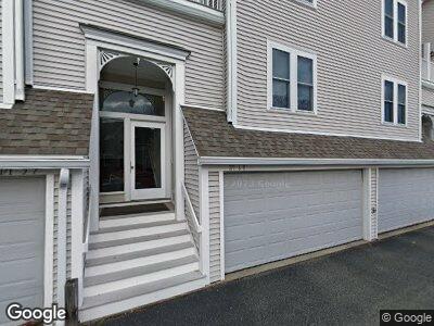
171 Walnut St Unit 11 Dorchester, MA 02122
Neponset-Port Norfolk NeighborhoodEstimated Value: $626,000 - $758,000
2
Beds
3
Baths
1,347
Sq Ft
$524/Sq Ft
Est. Value
About This Home
This home is located at 171 Walnut St Unit 11, Dorchester, MA 02122 and is currently estimated at $705,684, approximately $523 per square foot. 171 Walnut St Unit 11 is a home located in Suffolk County with nearby schools including Neighborhood House Charter School, St Brendan School, and Quincy Catholic Academy.
Ownership History
Date
Name
Owned For
Owner Type
Purchase Details
Closed on
Jun 8, 1993
Sold by
Selvidge Charles W and Selvidge Maureen E
Bought by
Griswold F Matthew and Griswold Christopher N
Current Estimated Value
Home Financials for this Owner
Home Financials are based on the most recent Mortgage that was taken out on this home.
Original Mortgage
$124,000
Interest Rate
7.33%
Mortgage Type
Purchase Money Mortgage
Create a Home Valuation Report for This Property
The Home Valuation Report is an in-depth analysis detailing your home's value as well as a comparison with similar homes in the area
Home Values in the Area
Average Home Value in this Area
Purchase History
| Date | Buyer | Sale Price | Title Company |
|---|---|---|---|
| Griswold F Matthew | $155,000 | -- |
Source: Public Records
Mortgage History
| Date | Status | Borrower | Loan Amount |
|---|---|---|---|
| Closed | Griswold F Matthew | $124,000 |
Source: Public Records
Tax History Compared to Growth
Tax History
| Year | Tax Paid | Tax Assessment Tax Assessment Total Assessment is a certain percentage of the fair market value that is determined by local assessors to be the total taxable value of land and additions on the property. | Land | Improvement |
|---|---|---|---|---|
| 2025 | $8,310 | $717,600 | $0 | $717,600 |
| 2024 | $6,872 | $630,500 | $0 | $630,500 |
| 2023 | $6,573 | $612,000 | $0 | $612,000 |
| 2022 | $6,281 | $577,300 | $0 | $577,300 |
| 2021 | $5,981 | $560,500 | $0 | $560,500 |
| 2020 | $5,043 | $477,600 | $0 | $477,600 |
| 2019 | $4,748 | $450,500 | $0 | $450,500 |
| 2018 | $4,372 | $417,200 | $0 | $417,200 |
| 2017 | $4,054 | $382,800 | $0 | $382,800 |
| 2016 | $3,936 | $357,800 | $0 | $357,800 |
| 2015 | $4,372 | $361,000 | $0 | $361,000 |
| 2014 | $4,165 | $331,100 | $0 | $331,100 |
Source: Public Records
Map
Nearby Homes
- 119 Walnut St
- 88 Walnut St Unit 2
- 5 Rice St Unit 3
- 7 Lorenzo St
- 378 Neponset Ave
- 364 Neponset Ave Unit 4
- 4 Chickatawbut St
- 22 Chickatawbut St Unit 2
- 48 Coffey St Unit 5D
- 90 Quincy Shore Dr Unit 110
- 90 Quincy Shore Dr Unit 404
- 90 Quincy Shore Dr Unit 107
- 37 Coffey St Unit 4
- 133 Commander Shea Blvd Unit 406
- 133 Commander Shea Blvd Unit 515
- 199 Victory Rd
- 35 Coffey St Unit 6
- 57 Quincy Shore Dr Unit 412
- 185 Quincy Shore Dr Unit A75
- 10 Coffey St Unit 10