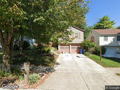
1714 Laramie Dr Powell, OH 43065
Western Hills NeighborhoodEstimated Value: $305,928 - $355,000
3
Beds
2
Baths
1,150
Sq Ft
$285/Sq Ft
Est. Value
About This Home
This home is located at 1714 Laramie Dr, Powell, OH 43065 and is currently estimated at $327,232, approximately $284 per square foot. 1714 Laramie Dr is a home located in Franklin County with nearby schools including Liberty Elementary School, McCord Middle School, and Worthington Kilbourne High School.
Ownership History
Date
Name
Owned For
Owner Type
Purchase Details
Closed on
Dec 27, 1996
Sold by
Russo Michelle L
Bought by
Sabatha B Umoette
Current Estimated Value
Home Financials for this Owner
Home Financials are based on the most recent Mortgage that was taken out on this home.
Original Mortgage
$102,505
Interest Rate
7.64%
Mortgage Type
FHA
Purchase Details
Closed on
Jun 16, 1994
Sold by
Leo Philomena L
Bought by
Michelle L Russo
Home Financials for this Owner
Home Financials are based on the most recent Mortgage that was taken out on this home.
Original Mortgage
$70,400
Interest Rate
7.75%
Mortgage Type
New Conventional
Purchase Details
Closed on
Dec 17, 1990
Create a Home Valuation Report for This Property
The Home Valuation Report is an in-depth analysis detailing your home's value as well as a comparison with similar homes in the area
Home Values in the Area
Average Home Value in this Area
Purchase History
| Date | Buyer | Sale Price | Title Company |
|---|---|---|---|
| Sabatha B Umoette | $105,000 | -- | |
| Michelle L Russo | $88,000 | -- | |
| -- | -- | -- |
Source: Public Records
Mortgage History
| Date | Status | Borrower | Loan Amount |
|---|---|---|---|
| Open | Umoette Sabatha B | $116,000 | |
| Closed | Umoette Sabatha B | $47,000 | |
| Closed | Umoette Sabatha B | $94,000 | |
| Closed | Sabatha B Umoette | $102,505 | |
| Previous Owner | Michelle L Russo | $70,400 |
Source: Public Records
Tax History Compared to Growth
Tax History
| Year | Tax Paid | Tax Assessment Tax Assessment Total Assessment is a certain percentage of the fair market value that is determined by local assessors to be the total taxable value of land and additions on the property. | Land | Improvement |
|---|---|---|---|---|
| 2024 | $5,518 | $89,880 | $27,230 | $62,650 |
| 2023 | $5,277 | $89,880 | $27,230 | $62,650 |
| 2022 | $4,638 | $62,690 | $14,460 | $48,230 |
| 2021 | $4,279 | $62,690 | $14,460 | $48,230 |
| 2020 | $4,122 | $62,690 | $14,460 | $48,230 |
| 2019 | $3,810 | $52,290 | $12,040 | $40,250 |
| 2018 | $3,654 | $52,290 | $12,040 | $40,250 |
| 2017 | $3,515 | $52,290 | $12,040 | $40,250 |
| 2016 | $3,616 | $50,930 | $12,500 | $38,430 |
| 2015 | $3,616 | $50,930 | $12,500 | $38,430 |
| 2014 | $3,615 | $50,930 | $12,500 | $38,430 |
| 2013 | $1,799 | $50,925 | $12,495 | $38,430 |
Source: Public Records
Map
Nearby Homes
- 1539 Clubview Blvd S
- 1952 Laramie Dr Unit 14
- 8210 Laramie Place Unit 8
- 1934 Sutter Pkwy
- 8470 Seabright Dr
- 1546 Oakview Dr
- 1502 Markland St
- 2074 Hard Rd
- 1336 Hickory Ridge Ln
- 2119 Sutter Pkwy
- 7725 Sagemeadow Ct
- 1042 Circle On the Green
- 1902 Slaton Ct
- 1133 Blind Brook Dr
- 1939 Slaton Ct Unit 1939
- 8796 Seabright Dr
- 8779 Yates Point Ct
- 1068 Rutherglen Dr
- 7615 Foxboro Ln
- 1018 Rutherglen Dr