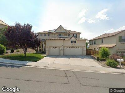
1727 Cloud Peak Dr Sparks, NV 89436
Los Altos Parkway NeighborhoodEstimated Value: $657,000 - $884,000
4
Beds
3
Baths
2,700
Sq Ft
$285/Sq Ft
Est. Value
About This Home
This home is located at 1727 Cloud Peak Dr, Sparks, NV 89436 and is currently estimated at $769,643, approximately $285 per square foot. 1727 Cloud Peak Dr is a home located in Washoe County with nearby schools including Bud Beasley Elementary School, Edward C Reed High School, and Excel Christian School.
Ownership History
Date
Name
Owned For
Owner Type
Purchase Details
Closed on
Dec 16, 2009
Sold by
Borja Gerardo A and Reyes Martha
Bought by
Thomas Quinton
Current Estimated Value
Home Financials for this Owner
Home Financials are based on the most recent Mortgage that was taken out on this home.
Original Mortgage
$268,055
Interest Rate
4.91%
Mortgage Type
FHA
Purchase Details
Closed on
Sep 30, 2005
Sold by
T M B Builders Llc
Bought by
Borja Gerardo A and Reyes Martha
Home Financials for this Owner
Home Financials are based on the most recent Mortgage that was taken out on this home.
Original Mortgage
$437,132
Interest Rate
1%
Mortgage Type
Negative Amortization
Create a Home Valuation Report for This Property
The Home Valuation Report is an in-depth analysis detailing your home's value as well as a comparison with similar homes in the area
Home Values in the Area
Average Home Value in this Area
Purchase History
| Date | Buyer | Sale Price | Title Company |
|---|---|---|---|
| Thomas Quinton | $273,000 | Western Title Inc Ridge | |
| Borja Gerardo A | $546,500 | Stewart Title Of Northern Nv |
Source: Public Records
Mortgage History
| Date | Status | Borrower | Loan Amount |
|---|---|---|---|
| Open | Thomas Qauinton | $241,259 | |
| Closed | Thomas Quinton | $268,055 | |
| Previous Owner | Borja Gerardo A | $437,132 |
Source: Public Records
Tax History Compared to Growth
Tax History
| Year | Tax Paid | Tax Assessment Tax Assessment Total Assessment is a certain percentage of the fair market value that is determined by local assessors to be the total taxable value of land and additions on the property. | Land | Improvement |
|---|---|---|---|---|
| 2025 | $4,601 | $209,666 | $55,613 | $154,053 |
| 2024 | $4,601 | $209,559 | $54,635 | $154,924 |
| 2023 | $4,468 | $201,185 | $54,635 | $146,550 |
| 2022 | $4,338 | $173,327 | $51,461 | $121,867 |
| 2021 | $4,212 | $169,180 | $48,228 | $120,952 |
| 2020 | $4,087 | $167,856 | $46,662 | $121,194 |
| 2019 | $3,969 | $160,051 | $43,832 | $116,219 |
| 2018 | $3,854 | $135,420 | $38,833 | $96,587 |
| 2017 | $3,743 | $134,979 | $38,404 | $96,575 |
| 2016 | $3,624 | $130,273 | $38,588 | $91,685 |
| 2015 | $3,616 | $121,286 | $29,584 | $91,702 |
| 2014 | $3,510 | $110,874 | $26,338 | $84,536 |
| 2013 | -- | $92,844 | $23,214 | $69,630 |
Source: Public Records
Map
Nearby Homes
- 1675 Crestside Ct
- 1685 Southview Dr
- 4725 Chipwood Dr
- 4755 Vista Mountain Dr
- 4802 Brunello Dr
- 4853 Santenay Ln
- 2184 Stone View Dr
- 1426 Golddust Dr Unit 2C
- 2191 Talladega Ct
- 4733 N Desert Brush Ct
- 2265 Vista Terrace Ln
- 5215 Canyon View Dr
- 5062 Dubonnet Dr
- 1357 Silver View Cir
- 1351 Silver View Cir
- 1239 Silver View Cir
- 1348 Silver View Cir
- 1352 Silver View Cir
- 1358 Silver View Cir Unit Homesite 39
- 1328 Silver View Cir