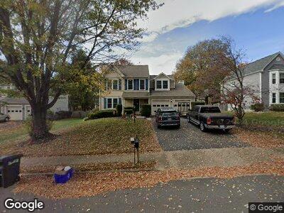
17371 Hilltop Dr Purcellville, VA 20132
Estimated Value: $740,608 - $802,000
4
Beds
3
Baths
2,240
Sq Ft
$343/Sq Ft
Est. Value
About This Home
This home is located at 17371 Hilltop Dr, Purcellville, VA 20132 and is currently estimated at $767,402, approximately $342 per square foot. 17371 Hilltop Dr is a home located in Loudoun County with nearby schools including Kenneth W. Culbert Elementary School, Blue Ridge Middle School, and Loudoun Valley High School.
Ownership History
Date
Name
Owned For
Owner Type
Purchase Details
Closed on
Jul 18, 2018
Sold by
Peworchik James A and Peworchik Marilyn E
Bought by
Brick Patrick W and Brick Melissa R
Current Estimated Value
Home Financials for this Owner
Home Financials are based on the most recent Mortgage that was taken out on this home.
Original Mortgage
$352,000
Interest Rate
4.5%
Mortgage Type
New Conventional
Purchase Details
Closed on
Aug 23, 1996
Sold by
Fifer Stephen B
Bought by
Peworchik James A
Home Financials for this Owner
Home Financials are based on the most recent Mortgage that was taken out on this home.
Original Mortgage
$100,000
Interest Rate
8.4%
Create a Home Valuation Report for This Property
The Home Valuation Report is an in-depth analysis detailing your home's value as well as a comparison with similar homes in the area
Home Values in the Area
Average Home Value in this Area
Purchase History
| Date | Buyer | Sale Price | Title Company |
|---|---|---|---|
| Brick Patrick W | $440,000 | Title Resources Guaranty Co | |
| Peworchik James A | $195,000 | -- |
Source: Public Records
Mortgage History
| Date | Status | Borrower | Loan Amount |
|---|---|---|---|
| Open | Brick Patrick W | $351,300 | |
| Closed | Brick Patrick W | $352,000 | |
| Previous Owner | Peworchik James A | $100,000 |
Source: Public Records
Tax History Compared to Growth
Tax History
| Year | Tax Paid | Tax Assessment Tax Assessment Total Assessment is a certain percentage of the fair market value that is determined by local assessors to be the total taxable value of land and additions on the property. | Land | Improvement |
|---|---|---|---|---|
| 2024 | $5,911 | $660,460 | $212,300 | $448,160 |
| 2023 | $5,404 | $617,620 | $212,300 | $405,320 |
| 2022 | $5,079 | $570,700 | $184,900 | $385,800 |
| 2021 | $4,986 | $508,810 | $144,900 | $363,910 |
| 2020 | $4,662 | $450,400 | $144,900 | $305,500 |
| 2019 | $4,496 | $430,250 | $124,900 | $305,350 |
| 2018 | $4,409 | $406,340 | $124,900 | $281,440 |
| 2017 | $4,482 | $398,360 | $124,900 | $273,460 |
| 2016 | $4,504 | $393,340 | $0 | $0 |
| 2015 | $4,477 | $269,560 | $0 | $269,560 |
| 2014 | $4,465 | $261,670 | $0 | $261,670 |
Source: Public Records
Map
Nearby Homes
- 132 Misty Pond Terrace
- 134 Misty Pond Terrace
- 37685 Saint Francis Ct
- 400 Mcdaniel Dr
- 211 Heaton Ct
- 916 Queenscliff Ct
- 14629 Fordson Ct
- 14649 Fordson Ct
- 460 S Maple Ave
- 625 E G St
- 305 E Declaration Ct
- 228 E King James St
- 116 Desales Dr
- 229 E Skyline Dr
- 17723 Karen Hope Ct
- 161 N Hatcher Ave
- 151 N Hatcher Ave
- 141 N Hatcher Ave
- 140 S 20th St
- 37957 Piggott Bottom Rd