

17390 Big Buck Rd Sisters, OR 97759
Estimated payment $2,611/month
Highlights
- Horse Property
- 39.54 Acre Lot
- No HOA
- Sisters Elementary School Rated A-
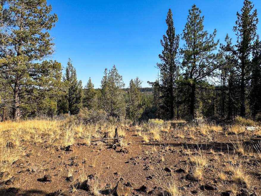
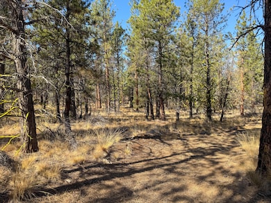
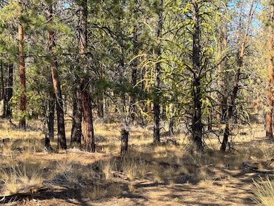
- Forest View
- Property is near a preserve or public land
About This Lot
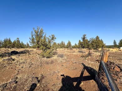
Tucked away in the heart of Central Oregon, this 40-acre property offers a rare opportunity to own a truly unique and captivating natural haven. Boasting a picturesque landscape of towering ponderosa pines and ancient junipers, this tranquil acreage beckons those seeking to immerse themselves in the beauty of the great outdoors. This secluded property offers convenient access to unspoiled nature. Public lands bordering on two sides, make it ideal for horseback riding, hiking, and other outdoor activities. Power is available, a Soils Report has been completed, and Conditional Use Permit has been initiated. This land offers a stunning and tranquil environment with high desert views, creating the perfect blank canvas for a dream estate or outdoor getaway.
Property Details
Property Type
- Land
Est. Annual Taxes
- $2,626
Lot Details
- 39.54 Acre Lot
- Dirt Road
- Property is zoned EFUSC / WA, EFUSC / WA
Property Views
- Forest Views
Schools
- Sisters Elementary School
- Sisters Middle School
- Sisters High School
Listing and Financial Details
- Legal Lot and Block 8 / 1
- Assessor Parcel Number 155587
Community Details
Overview
- No Home Owners Association
- Fremont Canyon Subdivision
- Property is near a preserve or public land
Recreation
- Horse Property
Map
Home Values in the Area
Average Home Value in this Area
Tax History
| Year | Tax Paid | Tax Assessment Tax Assessment Total Assessment is a certain percentage of the fair market value that is determined by local assessors to be the total taxable value of land and additions on the property. | Land | Improvement |
|---|---|---|---|---|
| 2024 | $2,626 | $199,800 | $199,800 | -- |
| 2023 | $2,562 | $193,990 | $193,990 | $0 |
| 2022 | $2,323 | $182,860 | $0 | $0 |
| 2021 | $2,334 | $177,540 | $0 | $0 |
| 2020 | $2,196 | $177,540 | $0 | $0 |
| 2019 | $2,151 | $172,370 | $0 | $0 |
| 2018 | $2,092 | $167,350 | $0 | $0 |
| 2017 | $2,014 | $162,480 | $0 | $0 |
| 2016 | $2,001 | $157,750 | $0 | $0 |
| 2015 | $1,866 | $153,160 | $0 | $0 |
| 2014 | $1,797 | $148,700 | $0 | $0 |
Property History
| Date | Event | Price | Change | Sq Ft Price |
|---|---|---|---|---|
| 11/13/2024 11/13/24 | For Sale | $429,500 | +79.0% | -- |
| 07/22/2020 07/22/20 | Sold | $240,000 | -19.7% | -- |
| 07/07/2020 07/07/20 | Pending | -- | -- | -- |
| 06/13/2019 06/13/19 | For Sale | $299,000 | -- | -- |
Deed History
| Date | Type | Sale Price | Title Company |
|---|---|---|---|
| Warranty Deed | $240,000 | Western Title & Escrow |
Source: Southern Oregon MLS
MLS Number: 220192640
APN: 155587
Disclaimer: Certain information contained herein is derived from information provided by parties other than Homes.com. All information provided is deemed reliable, but is not guaranteed to be accurate and should be independently verified.
![]() © 2025 Oregon Datashare (KCAR | MLSCO | SOMLS). All rights reserved. The data relating to real estate for sale on this web site comes in part from the Internet Data Exchange Program of the Oregon Datashare. Real estate listings held by IDX Brokerage firms other than Ten-X are marked with the Internet Data Exchange logo or the Internet Data Exchange thumbnail logo and detailed information about them includes the name of the listing Brokers. Information provided is for consumers' personal, non-commercial use and may not be used for any purpose other than to identify prospective properties the viewer may be interested in purchasing. The consumer will not copy, retransmit nor redistribute any of the content from this website. Information provided is deemed reliable, but not guaranteed.
© 2025 Oregon Datashare (KCAR | MLSCO | SOMLS). All rights reserved. The data relating to real estate for sale on this web site comes in part from the Internet Data Exchange Program of the Oregon Datashare. Real estate listings held by IDX Brokerage firms other than Ten-X are marked with the Internet Data Exchange logo or the Internet Data Exchange thumbnail logo and detailed information about them includes the name of the listing Brokers. Information provided is for consumers' personal, non-commercial use and may not be used for any purpose other than to identify prospective properties the viewer may be interested in purchasing. The consumer will not copy, retransmit nor redistribute any of the content from this website. Information provided is deemed reliable, but not guaranteed.
- 70255 Mustang Dr
- 70325 Club Rd
- 17920 Mountain View Rd
- 17400 Spur Dr
- 17725 Mountain View Rd
- 70177 Sorrell Dr
- 70168 Longhorn Dr
- 70163 Longhorn Dr
- 70179 Cayuse Place
- 70136 Cayuse Dr
- 70119 Pinto Dr
- 17945 Mountain View Rd
- 70129 Cayuse Dr
- 17250 Mountain View Rd
- 17785 Wilt Rd
- 17046 Vista Ridge Dr
- 16926 Canyon Crest Dr
- 16440 Fair Mile Rd
- 69580 Pine Ridge Dr
- 69435 Green Ridge Loop
