
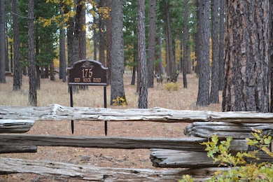
175 Red Rock Rd McArthur, CA 96056
Estimated payment $960/month
Highlights
- Views of Trees
- Partially Fenced Property
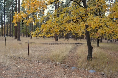
- Level Lot
- 10.4 Acre Lot
About This Lot
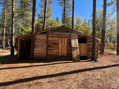
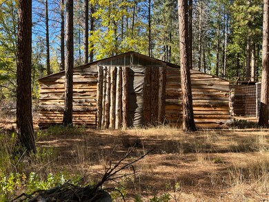
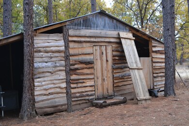
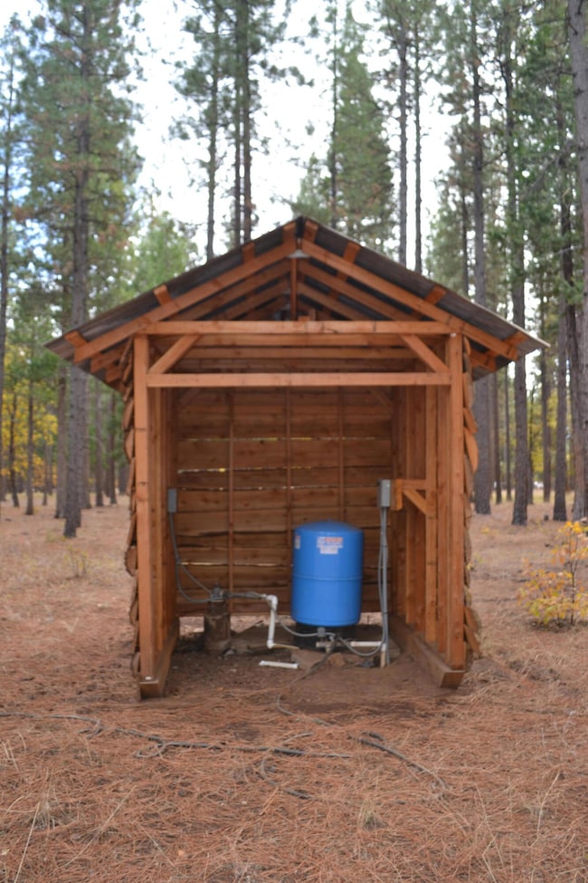
Simply beautiful! This level 10.4 acre property lays under mature oaks and pines. Power, water well and septic are in and ready for your imagination. Small barn and a few small outbuildings are already in place. Plus, a unique outdoor shower! Several homesite areas, think of the fun it will be to find your perfect location. A seasonal water stream passes through the property. The land appears to be fairly free of rocks, great garden and pasture opportunity. Located in Modoc County at the end of Red Rock Road, privacy is a nice incentive. Backs up to BLM land to the west. Note: Well and septic were in when owner purchased the property in 2021 and has never use or tested septic system.
Property Details
Property Type
- Land
Est. Annual Taxes
- $1,490
Lot Details
- 10.4 Acre Lot
- Dirt Road
- Partially Fenced Property
- Wood Fence
- Level Lot
Property Views
- Views of Trees
Listing and Financial Details
- Assessor Parcel Number 011-420-045-000
Map
Home Values in the Area
Average Home Value in this Area
Tax History
| Year | Tax Paid | Tax Assessment Tax Assessment Total Assessment is a certain percentage of the fair market value that is determined by local assessors to be the total taxable value of land and additions on the property. | Land | Improvement |
|---|---|---|---|---|
| 2024 | $1,490 | $135,250 | $121,965 | $13,285 |
| 2023 | $1,470 | $132,599 | $119,574 | $13,025 |
| 2022 | $1,428 | $130,000 | $117,230 | $12,770 |
| 2021 | $542 | $47,630 | $41,290 | $6,340 |
| 2020 | $545 | $47,630 | $41,290 | $6,340 |
| 2019 | $535 | $47,630 | $41,290 | $6,340 |
| 2018 | $566 | $47,630 | $41,290 | $6,340 |
| 2017 | $649 | $56,902 | $50,338 | $6,564 |
| 2016 | $631 | $55,787 | $49,351 | $6,436 |
| 2015 | $624 | $54,950 | $48,610 | $6,340 |
| 2014 | $634 | $52,919 | $47,310 | $5,609 |
Property History
| Date | Event | Price | Change | Sq Ft Price |
|---|---|---|---|---|
| 11/07/2024 11/07/24 | For Sale | $150,000 | -- | -- |
Deed History
| Date | Type | Sale Price | Title Company |
|---|---|---|---|
| Grant Deed | $130,000 | Placer Title Company | |
| Grant Deed | $55,000 | Modoc County Title Co | |
| Individual Deed | -- | Modoc County Title Co |
Source: Shasta Association of REALTORS®
MLS Number: 24-4742
APN: 011-420-045-000
Disclaimer: Certain information contained herein is derived from information provided by parties other than Homes.com. All information provided is deemed reliable, but is not guaranteed to be accurate and should be independently verified.
![]() IDX information is provided exclusively for personal, non-commercial use, and may not be used for any purpose other than to identify prospective properties consumers may be interested in purchasing. Information is deemed reliable but not guaranteed.
IDX information is provided exclusively for personal, non-commercial use, and may not be used for any purpose other than to identify prospective properties consumers may be interested in purchasing. Information is deemed reliable but not guaranteed.
- 44942 Pine Shadows Rd
- 44992 Old Brown Ranch Rd
- 000 Badger Ln
- 45450 Big Lake Rd
- 0 Day Rd Unit 24-4411
- 29360 Day
- 28960 Day Rd
- 640-775 Iris Rd
- 641-355 Roberts Dr
- 27744 Lee Rd
- 641 -655 Circle Oaks Dr
- 26953 Lee Rd
- 42369 Horr Rd
- 42369 Horr Rd
- 45264 State Highway 299e
- 26989 Lee Rd
- 45258 California 299
- 75 Pine Dr
- 31 Juniper Way
- 44991 State Highway 299e
