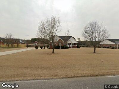
1774 Gant Rd Scottsboro, AL 35769
Estimated Value: $286,000 - $389,000
--
Bed
--
Bath
1,792
Sq Ft
$185/Sq Ft
Est. Value
About This Home
This home is located at 1774 Gant Rd, Scottsboro, AL 35769 and is currently estimated at $332,248, approximately $185 per square foot. 1774 Gant Rd is a home located in Jackson County with nearby schools including Scottsboro High School.
Ownership History
Date
Name
Owned For
Owner Type
Purchase Details
Closed on
Apr 24, 2012
Sold by
Bradford Melanie B and Neeley Income Only Trust Dated
Bought by
Neeley Gordon M
Current Estimated Value
Purchase Details
Closed on
May 24, 2010
Sold by
Newsome Barbara
Bought by
Neeley Income Only Trust Established On
Purchase Details
Closed on
May 11, 2010
Sold by
Neeley Curtis E and Neeley Carolyn
Bought by
Neeley Income Only Trust Established On
Purchase Details
Closed on
Nov 3, 2008
Sold by
Newsom Barbara
Bought by
Hyde Chass and Hyde Tashia
Home Financials for this Owner
Home Financials are based on the most recent Mortgage that was taken out on this home.
Original Mortgage
$182,000
Interest Rate
6.11%
Mortgage Type
Purchase Money Mortgage
Create a Home Valuation Report for This Property
The Home Valuation Report is an in-depth analysis detailing your home's value as well as a comparison with similar homes in the area
Home Values in the Area
Average Home Value in this Area
Purchase History
| Date | Buyer | Sale Price | Title Company |
|---|---|---|---|
| Neeley Gordon M | -- | -- | |
| Neeley Income Only Trust Established On | -- | -- | |
| Hyde Chass | $225,000 | -- |
Source: Public Records
Mortgage History
| Date | Status | Borrower | Loan Amount |
|---|---|---|---|
| Previous Owner | Hyde Chastidyk | $185,900 | |
| Previous Owner | Hyde Chass | $182,000 |
Source: Public Records
Tax History Compared to Growth
Tax History
| Year | Tax Paid | Tax Assessment Tax Assessment Total Assessment is a certain percentage of the fair market value that is determined by local assessors to be the total taxable value of land and additions on the property. | Land | Improvement |
|---|---|---|---|---|
| 2024 | $1,038 | $22,420 | $0 | $0 |
| 2023 | $1,038 | $22,420 | $0 | $0 |
| 2022 | $1,035 | $22,360 | $0 | $0 |
| 2021 | $1,035 | $22,360 | $0 | $0 |
| 2020 | $885 | $19,260 | $0 | $0 |
| 2019 | $877 | $19,100 | $0 | $0 |
| 2018 | $903 | $19,620 | $0 | $0 |
| 2017 | $903 | $196,000 | $0 | $0 |
| 2016 | $856 | $186,500 | $0 | $0 |
| 2015 | $812 | $186,500 | $0 | $0 |
| 2014 | $747 | $164,200 | $0 | $0 |
| 2013 | -- | $164,200 | $0 | $0 |
Source: Public Records
Map
Nearby Homes
- 304 Bethany Dr
- 3.6 acres Gant Rd
- 130 Marsie Ave
- TRACT A Richard Ave
- 39 Richard Ave
- 82 Richard Ave
- .68 Acres Veterans Dr
- 2410 Veterans Dr
- 2349 County Road 33
- 229 Crawford Rd
- 143 Green St
- 164 Twin Oaks St
- 114 Cherokee Rd
- 25924 John T Reid Pkwy
- 508 Highland Ave
- 126 Hurt St
- 2 Lots Trail Ridge Rd
- 0 N George Adams Rd Unit 21883091
- 209 Dawson St
- 2205 E Willow St