
17848 Andrea Way Anderson, CA 96007
Happy Valley NeighborhoodEstimated payment $772/month
Total Views
4,709
16
Acres
$8,013
Price per Acre
679,536
Sq Ft Lot
Highlights
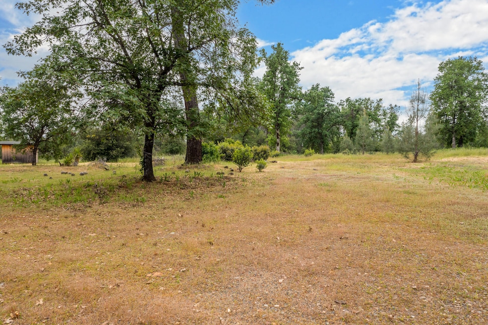
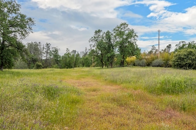
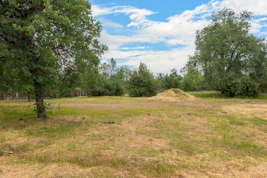
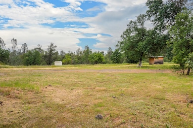
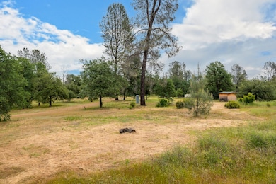
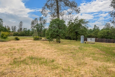
- 15.6 Acre Lot
- Hilly Lot
- Level Lot
- Mountain View
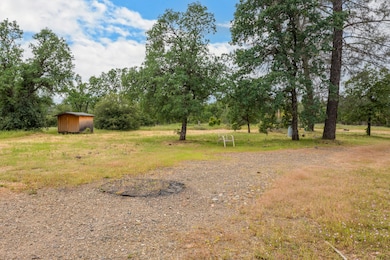
- Wood Fence
About This Lot
Situated in a serene and private setting, the property at 17848 Andrea Way, offers a rare opportunity to build your dream home on a substantial 15.60-acre plot. This beautiful parcel has a well and septic system already installed, ensuring essential services are on hand. Additionally, a newer power pole has been added to the site, enhancing its readiness for development.
The allure of this property is enhanced by its private setting. It features front privacy fencing that promotes a secluded environment, ideal for those seeking tranquility away from city noise. The access via a private, quiet road adds to the exclusivity of this location, making it a secure and peaceful retreat.
Property Details
Property Type
- Land
Est. Annual Taxes
- $888
Lot Details
- 15.6 Acre Lot
- Dirt Road
- Wood Fence
- Level Lot
- Hilly Lot
Property Views
- Mountain
- Park or Greenbelt
Listing and Financial Details
- Assessor Parcel Number 206-010-017-000
Map
Create a Home Valuation Report for This Property
The Home Valuation Report is an in-depth analysis detailing your home's value as well as a comparison with similar homes in the area
Home Values in the Area
Average Home Value in this Area
Tax History
| Year | Tax Paid | Tax Assessment Tax Assessment Total Assessment is a certain percentage of the fair market value that is determined by local assessors to be the total taxable value of land and additions on the property. | Land | Improvement |
|---|---|---|---|---|
| 2024 | $888 | $78,503 | $68,267 | $10,236 |
| 2023 | $888 | $76,965 | $66,929 | $10,036 |
| 2022 | $867 | $75,457 | $65,617 | $9,840 |
| 2021 | $858 | $73,979 | $64,331 | $9,648 |
| 2020 | $851 | $73,222 | $63,672 | $9,550 |
| 2019 | $835 | $71,787 | $62,424 | $9,363 |
| 2018 | $815 | $70,380 | $61,200 | $9,180 |
| 2017 | $811 | $69,000 | $60,000 | $9,000 |
| 2016 | $810 | $71,067 | $60,915 | $10,152 |
| 2015 | $878 | $75,438 | $57,542 | $17,896 |
| 2014 | $871 | $73,961 | $56,415 | $17,546 |
Source: Public Records
Property History
| Date | Event | Price | Change | Sq Ft Price |
|---|---|---|---|---|
| 04/08/2025 04/08/25 | For Sale | $125,000 | +81.2% | -- |
| 12/21/2016 12/21/16 | Sold | $69,000 | -8.0% | -- |
| 11/30/2016 11/30/16 | Pending | -- | -- | -- |
| 10/30/2016 10/30/16 | For Sale | $75,000 | -- | -- |
Source: Shasta Association of REALTORS®
Deed History
| Date | Type | Sale Price | Title Company |
|---|---|---|---|
| Grant Deed | $69,000 | Placer Title Company | |
| Grant Deed | $59,000 | First American Title Co | |
| Trustee Deed | -- | Chicago Title |
Source: Public Records
Mortgage History
| Date | Status | Loan Amount | Loan Type |
|---|---|---|---|
| Previous Owner | $44,000 | Seller Take Back |
Source: Public Records
Similar Property in Anderson, CA
Source: Shasta Association of REALTORS®
MLS Number: 25-1440
APN: 206-010-017-000
Disclaimer: Certain information contained herein is derived from information provided by parties other than Homes.com. All information provided is deemed reliable, but is not guaranteed to be accurate and should be independently verified.
![]() IDX information is provided exclusively for personal, non-commercial use, and may not be used for any purpose other than to identify prospective properties consumers may be interested in purchasing. Information is deemed reliable but not guaranteed.
IDX information is provided exclusively for personal, non-commercial use, and may not be used for any purpose other than to identify prospective properties consumers may be interested in purchasing. Information is deemed reliable but not guaranteed.
Nearby Homes
- 17704 Warwick Place
- 5595 Dover Dr
- 5210 Dino Dr
- 17405 Maryann Ln
- 0 Olinda Rd Unit 20250158
- 0 Olinda Rd Unit 225013031
- 5110 Chestnut St
- 17187 Flowers Ln
- 6947 Happy Valley Rd
- 6876 Happy Valley Rd
- 17915 Arlington Ct
- 17900 Arlington Ct
- 17111 Fuzzy Ln
- Lot 10 Palm Ave
- Lot 9 Palm Ave
- Lot 8 Palm Ave
- Lot 7 Palm Ave
- Lot 5 Palm Ave
- Lot 4 Palm Ave
- Lot 3 Palm Ave