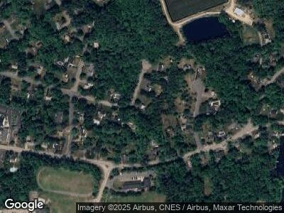
180 Jerrold St Hanson, MA 02341
Estimated Value: $557,131 - $721,000
4
Beds
2
Baths
1,500
Sq Ft
$403/Sq Ft
Est. Value
About This Home
This home is located at 180 Jerrold St, Hanson, MA 02341 and is currently estimated at $604,533, approximately $403 per square foot. 180 Jerrold St is a home located in Plymouth County.
Ownership History
Date
Name
Owned For
Owner Type
Purchase Details
Closed on
Apr 19, 2001
Sold by
Osullivan James J
Bought by
Osullivan Michael J
Current Estimated Value
Home Financials for this Owner
Home Financials are based on the most recent Mortgage that was taken out on this home.
Original Mortgage
$103,000
Interest Rate
6.9%
Mortgage Type
Purchase Money Mortgage
Create a Home Valuation Report for This Property
The Home Valuation Report is an in-depth analysis detailing your home's value as well as a comparison with similar homes in the area
Home Values in the Area
Average Home Value in this Area
Purchase History
| Date | Buyer | Sale Price | Title Company |
|---|---|---|---|
| Osullivan Michael J | $130,000 | -- |
Source: Public Records
Mortgage History
| Date | Status | Borrower | Loan Amount |
|---|---|---|---|
| Open | Osullivan Michael D | $205,000 | |
| Closed | Osullivan Michael J | $60,000 | |
| Closed | Osullivan Michael J | $150,000 | |
| Closed | Osullivan Michael J | $120,000 | |
| Closed | Osullivan Michael J | $103,000 |
Source: Public Records
Tax History Compared to Growth
Tax History
| Year | Tax Paid | Tax Assessment Tax Assessment Total Assessment is a certain percentage of the fair market value that is determined by local assessors to be the total taxable value of land and additions on the property. | Land | Improvement |
|---|---|---|---|---|
| 2025 | $5,967 | $446,000 | $185,300 | $260,700 |
| 2024 | $5,843 | $436,700 | $179,900 | $256,800 |
| 2023 | $5,723 | $403,600 | $179,900 | $223,700 |
| 2022 | $5,585 | $370,100 | $163,600 | $206,500 |
| 2021 | $4,963 | $328,700 | $157,300 | $171,400 |
| 2020 | $4,851 | $317,700 | $151,900 | $165,800 |
| 2019 | $4,690 | $302,000 | $149,000 | $153,000 |
| 2018 | $4,698 | $288,500 | $143,300 | $145,200 |
| 2017 | $4,423 | $276,800 | $136,500 | $140,300 |
| 2016 | $4,482 | $270,800 | $136,500 | $134,300 |
| 2015 | $4,260 | $267,600 | $136,500 | $131,100 |
Source: Public Records
Map
Nearby Homes
- 28 George St
- 31 Indian Trail
- 269 Lakeside Rd
- 42 Jean St
- 56 Katy Did Ln
- Lot 6 Princeton Way
- Lot 8 Princeton Way
- Lot 4 Princeton Way
- Lot 2 Harvard Rd
- 4 Taylor Point Rd
- 396 Mattakeesett St
- 84 Liberty St
- 21 Beechwood Ave
- 9 Cynthia Ave
- 60 Pine Tree Ln
- 248 E Washington St
- 136 Rosewood Dr
- Lot 5 Princeton Way
- Lot 7 Princeton Way
- 56 Country Club Cir
