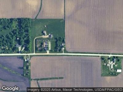
1801 Prairie Chapel Rd Marion, IA 52302
Estimated Value: $301,000 - $332,000
4
Beds
2
Baths
1,432
Sq Ft
$218/Sq Ft
Est. Value
About This Home
This home is located at 1801 Prairie Chapel Rd, Marion, IA 52302 and is currently estimated at $312,556, approximately $218 per square foot. 1801 Prairie Chapel Rd is a home located in Linn County with nearby schools including Linn Grove Elementary School, Excelsior Middle School, and Linn-Mar High School.
Ownership History
Date
Name
Owned For
Owner Type
Purchase Details
Closed on
Mar 12, 2025
Sold by
Henderson Lloyd W and Henderson Sandra R
Bought by
Henderson Lloyd W and Henderson Sandra R
Current Estimated Value
Purchase Details
Closed on
Mar 21, 2008
Sold by
Henderson Lloyd W and Henderson Sandra R
Bought by
Henderson Lloyd W and Henderson Sandra R
Purchase Details
Closed on
Aug 14, 2003
Sold by
Nielson Norman R and Nielson Dora L
Bought by
Henderson Lloyd W
Home Financials for this Owner
Home Financials are based on the most recent Mortgage that was taken out on this home.
Original Mortgage
$118,755
Interest Rate
5.62%
Mortgage Type
FHA
Create a Home Valuation Report for This Property
The Home Valuation Report is an in-depth analysis detailing your home's value as well as a comparison with similar homes in the area
Home Values in the Area
Average Home Value in this Area
Purchase History
| Date | Buyer | Sale Price | Title Company |
|---|---|---|---|
| Henderson Lloyd W | -- | None Listed On Document | |
| Henderson Lloyd W | -- | None Listed On Document | |
| Henderson Lloyd W | -- | None Available | |
| Henderson Lloyd W | $151,500 | Midwest Community Title |
Source: Public Records
Mortgage History
| Date | Status | Borrower | Loan Amount |
|---|---|---|---|
| Previous Owner | Henderson Lloyd W | $107,120 | |
| Previous Owner | Henderson Lloyd W | $18,540 | |
| Previous Owner | Henderson Lloyd W | $118,755 |
Source: Public Records
Tax History Compared to Growth
Tax History
| Year | Tax Paid | Tax Assessment Tax Assessment Total Assessment is a certain percentage of the fair market value that is determined by local assessors to be the total taxable value of land and additions on the property. | Land | Improvement |
|---|---|---|---|---|
| 2023 | $3,026 | $252,300 | $62,300 | $190,000 |
| 2022 | $2,928 | $201,600 | $62,300 | $139,300 |
| 2021 | $2,922 | $201,600 | $62,300 | $139,300 |
| 2020 | $2,922 | $187,900 | $48,000 | $139,900 |
| 2019 | $2,740 | $176,900 | $48,000 | $128,900 |
| 2018 | $2,614 | $176,900 | $48,000 | $128,900 |
| 2017 | $2,703 | $172,500 | $48,000 | $124,500 |
| 2016 | $2,703 | $172,500 | $48,000 | $124,500 |
| 2015 | $2,723 | $172,500 | $48,000 | $124,500 |
| 2014 | $2,586 | $172,500 | $48,000 | $124,500 |
| 2013 | $2,482 | $172,500 | $48,000 | $124,500 |
Source: Public Records
Map
Nearby Homes
- 2868 Royal Oak Ridge Rd
- 3037 Royal Oak Ridge Rd
- 2995 Royal Oak Ridge Rd
- 3081 Duckhorn Cove
- 3420 Stanley Cup Dr
- 3220 Artesian Rd
- 5740 Woodbridge Crest
- 1823 Glen Rock Cir
- 1866 Cottage Ridge Dr
- 5560 Woodbridge Crest
- 1789 Glen Rock Cir
- 2933 Clubhouse Dr
- 2935 Clubhouse Dr
- 6400 Cakebread Ct
- 2933 Clubhouse Dr and 2935
- 1835 Valentine Dr
- 1542 Hunters Creek Way Unit 1542
- 1562 Hunters Creek Way Unit 1562
- 2975 Silver Oak Trail
- 2545 Silver Oak Trail
