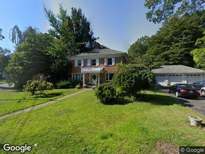
182 Pocahontas Dr Warwick, RI 02888
Palace Garden NeighborhoodEstimated Value: $760,737 - $911,000
4
Beds
3
Baths
3,024
Sq Ft
$276/Sq Ft
Est. Value
About This Home
This home is located at 182 Pocahontas Dr, Warwick, RI 02888 and is currently estimated at $835,434, approximately $276 per square foot. 182 Pocahontas Dr is a home located in Kent County with nearby schools including St. Peter School and Saint Kevin School.
Ownership History
Date
Name
Owned For
Owner Type
Purchase Details
Closed on
Jan 24, 1997
Sold by
Donovan Marie
Bought by
Ferla Vincent M and Ferla Mirnna
Current Estimated Value
Home Financials for this Owner
Home Financials are based on the most recent Mortgage that was taken out on this home.
Original Mortgage
$232,750
Interest Rate
7.5%
Mortgage Type
Purchase Money Mortgage
Create a Home Valuation Report for This Property
The Home Valuation Report is an in-depth analysis detailing your home's value as well as a comparison with similar homes in the area
Home Values in the Area
Average Home Value in this Area
Purchase History
| Date | Buyer | Sale Price | Title Company |
|---|---|---|---|
| Ferla Vincent M | $245,000 | -- |
Source: Public Records
Mortgage History
| Date | Status | Borrower | Loan Amount |
|---|---|---|---|
| Open | Ferla Vincent M | $163,000 | |
| Closed | Ferla Vincent M | $205,193 | |
| Closed | Ferla Vincent M | $232,750 |
Source: Public Records
Tax History Compared to Growth
Tax History
| Year | Tax Paid | Tax Assessment Tax Assessment Total Assessment is a certain percentage of the fair market value that is determined by local assessors to be the total taxable value of land and additions on the property. | Land | Improvement |
|---|---|---|---|---|
| 2024 | $8,850 | $611,600 | $130,500 | $481,100 |
| 2023 | $8,679 | $611,600 | $130,500 | $481,100 |
| 2022 | $8,758 | $467,600 | $89,000 | $378,600 |
| 2021 | $8,758 | $467,600 | $89,000 | $378,600 |
| 2020 | $8,758 | $467,600 | $89,000 | $378,600 |
| 2019 | $8,758 | $467,600 | $89,000 | $378,600 |
| 2018 | $8,705 | $418,500 | $81,300 | $337,200 |
| 2017 | $8,470 | $418,500 | $81,300 | $337,200 |
| 2016 | $8,470 | $418,500 | $81,300 | $337,200 |
| 2015 | $8,356 | $402,700 | $102,600 | $300,100 |
| 2014 | $8,078 | $402,700 | $102,600 | $300,100 |
| 2013 | $7,969 | $402,700 | $102,600 | $300,100 |
Source: Public Records
Map
Nearby Homes
- 294 Miantonomo Dr
- 320 Miantonomo Dr
- 20 4th Ave
- 22 Kendall Ln
- 28 4th Ave
- 26 Miantonomo Dr
- 44 Scranton Ave
- 72 W Shore Rd Unit 204
- 154 Twin Oak Dr
- 244 Harmony Ct
- 137 Kiwanee Rd
- 55 Knowles Dr
- 8 Druid Rd
- 136 Honeysuckle Rd
- 301 W Shore Rd Unit 16
- 188 Airport Rd
- 90 Waycross Dr
- 40 Lima St
- 46 Marquette Dr
- 26 Peeptoad Rd