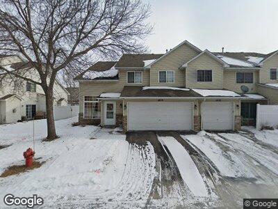
1835 1835 River Wood Dr Burnsville, MN 55337
Estimated Value: $219,000 - $222,000
2
Beds
2
Baths
1,175
Sq Ft
$187/Sq Ft
Est. Value
About This Home
This home is located at 1835 1835 River Wood Dr, Burnsville, MN 55337 and is currently estimated at $220,062, approximately $187 per square foot. 1835 1835 River Wood Dr is a home located in Dakota County with nearby schools including William Byrne Elementary School, Burnsville High School, and Gateway STEM Academy.
Ownership History
Date
Name
Owned For
Owner Type
Purchase Details
Closed on
Sep 20, 2010
Sold by
Minnesota Housing Finance Agency
Bought by
Stanina Scott G
Current Estimated Value
Purchase Details
Closed on
Apr 27, 2007
Sold by
Lunemann Travis and Lunemann Nicole
Bought by
Gehrke David G
Home Financials for this Owner
Home Financials are based on the most recent Mortgage that was taken out on this home.
Original Mortgage
$157,450
Interest Rate
6.2%
Mortgage Type
New Conventional
Purchase Details
Closed on
Dec 22, 2003
Sold by
First Centurion Corp
Bought by
Lunemann Travis
Purchase Details
Closed on
May 19, 2000
Sold by
Graham Michelle D
Bought by
Tran Phung T
Purchase Details
Closed on
Nov 22, 1996
Sold by
D R Horton Inc
Bought by
Graham Michelle D
Create a Home Valuation Report for This Property
The Home Valuation Report is an in-depth analysis detailing your home's value as well as a comparison with similar homes in the area
Home Values in the Area
Average Home Value in this Area
Purchase History
| Date | Buyer | Sale Price | Title Company |
|---|---|---|---|
| Gehrke David G | $157,450 | -- | |
| Lunemann Travis | $171,000 | -- | |
| Tran Phung T | $124,900 | -- | |
| Graham Michelle D | $82,831 | -- |
Source: Public Records
Mortgage History
| Date | Status | Borrower | Loan Amount |
|---|---|---|---|
| Previous Owner | Gehrke David G | $157,450 |
Source: Public Records
Tax History Compared to Growth
Tax History
| Year | Tax Paid | Tax Assessment Tax Assessment Total Assessment is a certain percentage of the fair market value that is determined by local assessors to be the total taxable value of land and additions on the property. | Land | Improvement |
|---|---|---|---|---|
| 2023 | $1,880 | $192,800 | $37,100 | $155,700 |
| 2022 | $1,592 | $191,700 | $37,000 | $154,700 |
| 2021 | $1,554 | $166,200 | $32,200 | $134,000 |
| 2020 | $1,556 | $155,600 | $30,700 | $124,900 |
| 2019 | $1,516 | $150,800 | $29,200 | $121,600 |
| 2018 | $1,355 | $141,600 | $27,000 | $114,600 |
| 2017 | $1,233 | $126,100 | $25,000 | $101,100 |
| 2016 | $1,249 | $116,300 | $23,800 | $92,500 |
| 2015 | $1,177 | $86,693 | $17,613 | $69,080 |
| 2014 | -- | $84,840 | $16,438 | $68,402 |
| 2013 | -- | $67,400 | $13,550 | $53,850 |
Source: Public Records
Map
Nearby Homes
- 1787 Riverwood Dr Unit 43
- 1800 Riverwood Dr Unit 303
- 2301 Horizon Cir
- 1809 Lannon Ct
- 2005 E 122nd St Unit A23
- 2009 E 122nd St Unit C16
- 2011 E 122nd St Unit D23
- 2007 E 122nd St Unit B15
- 2007 E 122nd St Unit B2
- 12232 Oak Leaf Cir
- 1706 E 123rd St
- 10 Westchester Square
- 12301 Michelle Cir
- 2325 E 117th St Unit 35
- 12274 River Valley Dr
- 2457 E 117th St Unit 22
- 1034 E Travelers Trail Unit 32
- 2713 River Hills Dr S
- 223 Birnamwood Dr
- 11843 River Hills Dr