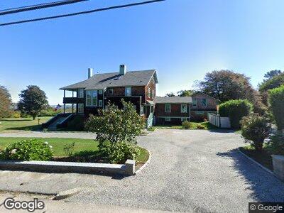
185 Walcott Ave Jamestown, RI 02835
Jamestown Village NeighborhoodEstimated Value: $3,637,000 - $6,009,000
7
Beds
5
Baths
4,437
Sq Ft
$1,009/Sq Ft
Est. Value
About This Home
This home is located at 185 Walcott Ave, Jamestown, RI 02835 and is currently estimated at $4,475,716, approximately $1,008 per square foot. 185 Walcott Ave is a home located in Newport County with nearby schools including Melrose Avenue School and Lawn Avenue School.
Ownership History
Date
Name
Owned For
Owner Type
Purchase Details
Closed on
Dec 12, 2012
Sold by
Balloch Liani I
Bought by
L I Balloch Ft and Balloch
Current Estimated Value
Purchase Details
Closed on
Oct 16, 2012
Sold by
Alfred H Jones Jr T H and Alfred Jones
Bought by
Irajanti-Balloch Liani
Create a Home Valuation Report for This Property
The Home Valuation Report is an in-depth analysis detailing your home's value as well as a comparison with similar homes in the area
Home Values in the Area
Average Home Value in this Area
Purchase History
| Date | Buyer | Sale Price | Title Company |
|---|---|---|---|
| L I Balloch Ft | -- | -- | |
| Irajanti-Balloch Liani | $1,100,000 | -- | |
| Irajanti-Balloch Liani | $1,100,000 | -- |
Source: Public Records
Mortgage History
| Date | Status | Borrower | Loan Amount |
|---|---|---|---|
| Previous Owner | Jones Alfred | $200,000 |
Source: Public Records
Tax History Compared to Growth
Tax History
| Year | Tax Paid | Tax Assessment Tax Assessment Total Assessment is a certain percentage of the fair market value that is determined by local assessors to be the total taxable value of land and additions on the property. | Land | Improvement |
|---|---|---|---|---|
| 2024 | $25,162 | $3,509,400 | $2,191,100 | $1,318,300 |
| 2023 | $24,619 | $3,527,100 | $2,191,100 | $1,336,000 |
| 2022 | $23,949 | $3,527,100 | $2,191,100 | $1,336,000 |
| 2021 | $21,993 | $2,656,100 | $1,638,400 | $1,017,700 |
| 2020 | $21,435 | $2,656,100 | $1,638,400 | $1,017,700 |
| 2019 | $21,382 | $2,656,100 | $1,638,400 | $1,017,700 |
| 2018 | $18,797 | $2,124,000 | $1,461,300 | $662,700 |
| 2017 | $18,306 | $2,113,900 | $1,461,300 | $652,600 |
| 2016 | $16,640 | $1,939,400 | $1,461,300 | $478,100 |
| 2015 | $20,175 | $2,297,800 | $1,765,000 | $532,800 |
| 2014 | $20,106 | $2,297,800 | $1,765,000 | $532,800 |
Source: Public Records
Map
Nearby Homes
- 2 Fort Wetherill Rd
- 152 Hamilton Ave
- 61 Howland Ave
- 55 Howland Ave
- 5 Clinton Ave
- 53 Conanicus Ave Unit 5A
- 53 Conanicus Ave Unit 1F
- 53 Conanicus Ave Unit 1D
- 53 Conanicus Ave Unit 2G
- 151 Narragansett Ave
- 65 Ridge Rd Unit T11/W38
- 65 Ridge Rd Unit G29/W24
- 65 Ridge Rd Unit T21/W23
- 65 Ridge Rd Unit G24/W28
- 65 Ridge Rd Unit P37
- 424 Beavertail Rd
- 41 Castle Hill Ave
- 6 Arnold St
- 19 Chartier Cir
- 15 Hammersmith Rd Unit 31