18655 Seclusion Dr Montgomry Crk, CA 96065
Estimated payment $696/month
Highlights
- Views of Trees
- 41.5 Acre Lot
- Level Lot
- Foothill High School Rated A-
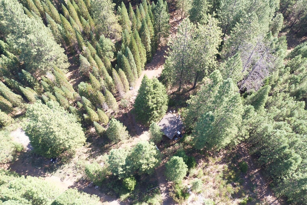
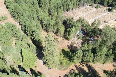
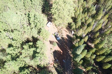
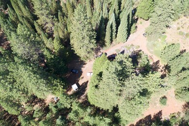
About This Lot
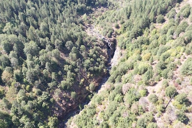
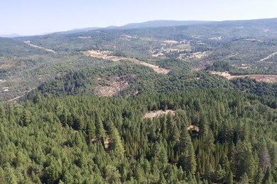
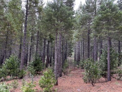
Situated just off Highway 299, this 40+ acre wooded parcel offers easy access via a well-maintained dirt road. It is home to diverse trees, including Doug Fir, Ponderosa Pines, and a Giant Sequoia plantation. The property also includes an existing well, septic, a nearby power pole, and a seasonal spring—making it ideal for a mountain home or recreational retreat. With mostly flat terrain and 125 acres of adjacent public land, this property offers exceptional privacy and potential. Cleanup is needed, but it's an opportunity to create your perfect mountain escape.

Property Details
Property Type
- Land
Est. Annual Taxes
- $1,060
Year Built
- 2000
Lot Details
- 41.5 Acre Lot
- Dirt Road
- Level Lot
- Zoning described as SC - TL - Timberland District
Property Views
- Views of Trees
Listing and Financial Details
- Assessor Parcel Number 029490003000
Map
Home Values in the Area
Average Home Value in this Area
Tax History
| Year | Tax Paid | Tax Assessment Tax Assessment Total Assessment is a certain percentage of the fair market value that is determined by local assessors to be the total taxable value of land and additions on the property. | Land | Improvement |
|---|---|---|---|---|
| 2024 | $1,060 | $91,800 | $71,400 | $20,400 |
| 2023 | $1,060 | $99,281 | $74,395 | $24,886 |
| 2022 | $1,034 | $97,336 | $72,937 | $24,399 |
| 2021 | $1,013 | $95,428 | $71,507 | $23,921 |
| 2020 | $1,015 | $94,450 | $70,774 | $23,676 |
| 2019 | $989 | $92,599 | $69,387 | $23,212 |
| 2018 | $980 | $90,784 | $68,027 | $22,757 |
| 2017 | $1,073 | $98,745 | $83,215 | $15,530 |
| 2016 | $1,013 | $96,810 | $81,584 | $15,226 |
| 2015 | $999 | $95,357 | $80,359 | $14,998 |
| 2014 | -- | $93,490 | $78,785 | $14,705 |
Property History
| Date | Event | Price | Change | Sq Ft Price |
|---|---|---|---|---|
| 01/13/2025 01/13/25 | For Sale | $109,000 | -- | -- |
Deed History
| Date | Type | Sale Price | Title Company |
|---|---|---|---|
| Public Action Common In Florida Clerks Tax Deed Or Tax Deeds Or Property Sold For Taxes | $60,301 | -- |
Source: Shasta Association of REALTORS®
MLS Number: 25-127
APN: 029-490-003-000
Disclaimer: Certain information contained herein is derived from information provided by parties other than Homes.com. All information provided is deemed reliable, but is not guaranteed to be accurate and should be independently verified.
![]() IDX information is provided exclusively for personal, non-commercial use, and may not be used for any purpose other than to identify prospective properties consumers may be interested in purchasing. Information is deemed reliable but not guaranteed.
IDX information is provided exclusively for personal, non-commercial use, and may not be used for any purpose other than to identify prospective properties consumers may be interested in purchasing. Information is deemed reliable but not guaranteed.
- 18655 Seclusion Dr
- 000 Finders Ferry Rd
- 000 Fenders Ferry Rd
- 29734 McNabb Cypress Rd
- 29801 Montgomery Creek Falls Rd
- 29944 White Pine Way
- 2 Parcels Patterson Ranch Rd
- 0 Patterson Ranch Rd
- 17759 Patterson Ranch Rd
- 19277 Woodhill Dr
- 0 Round Mountain Rd
- 0 Terry Mill Rd Unit 24-2100
- 20441 Cove Rd
- 4.75 acres Frisby Rd
- 30303 Frisby Rd
- 16483 Buzzard Roost Rd
- Lot 3 Hwy 299e
- 29219 Parks Rd
- 0 320 Acres Melton Rd Unit 24-2148
- 28457 Hwy 299