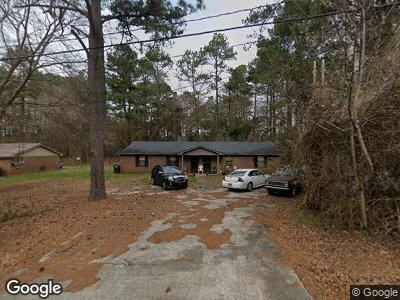
190 Ashmore Dr Athens, GA 30601
Estimated Value: $243,000 - $271,000
--
Bed
2
Baths
1,846
Sq Ft
$137/Sq Ft
Est. Value
About This Home
This home is located at 190 Ashmore Dr, Athens, GA 30601 and is currently estimated at $252,567, approximately $136 per square foot. 190 Ashmore Dr is a home located in Clarke County with nearby schools including Fowler Drive Elementary School, Coile Middle School, and Cedar Shoals High School.
Ownership History
Date
Name
Owned For
Owner Type
Purchase Details
Closed on
Aug 29, 2014
Sold by
First American Bank & Trust
Bought by
Vail Craig C
Current Estimated Value
Home Financials for this Owner
Home Financials are based on the most recent Mortgage that was taken out on this home.
Original Mortgage
$50,000
Interest Rate
4.19%
Mortgage Type
New Conventional
Purchase Details
Closed on
Jul 18, 2014
Sold by
Uhde P Lance
Bought by
First American Bank & Trust
Home Financials for this Owner
Home Financials are based on the most recent Mortgage that was taken out on this home.
Original Mortgage
$50,000
Interest Rate
4.19%
Mortgage Type
New Conventional
Purchase Details
Closed on
Dec 1, 1999
Sold by
Simpson Randy Michael and Simpson Frances E
Bought by
Annabella Uhde P and Annabella Uhde
Create a Home Valuation Report for This Property
The Home Valuation Report is an in-depth analysis detailing your home's value as well as a comparison with similar homes in the area
Home Values in the Area
Average Home Value in this Area
Purchase History
| Date | Buyer | Sale Price | Title Company |
|---|---|---|---|
| Vail Craig C | $39,000 | -- | |
| First American Bank & Trust | -- | -- | |
| Annabella Uhde P | $66,500 | -- |
Source: Public Records
Mortgage History
| Date | Status | Borrower | Loan Amount |
|---|---|---|---|
| Closed | Vail Craig C | $50,000 |
Source: Public Records
Tax History Compared to Growth
Tax History
| Year | Tax Paid | Tax Assessment Tax Assessment Total Assessment is a certain percentage of the fair market value that is determined by local assessors to be the total taxable value of land and additions on the property. | Land | Improvement |
|---|---|---|---|---|
| 2024 | $2,749 | $87,967 | $12,000 | $75,967 |
| 2023 | $2,749 | $71,611 | $10,400 | $61,211 |
| 2022 | $1,893 | $59,348 | $10,400 | $48,948 |
| 2021 | $1,278 | $37,937 | $8,000 | $29,937 |
| 2020 | $1,243 | $36,887 | $8,000 | $28,887 |
| 2019 | $1,157 | $34,092 | $8,000 | $26,092 |
| 2018 | $1,083 | $31,898 | $7,200 | $24,698 |
| 2017 | $812 | $23,913 | $7,200 | $16,713 |
| 2016 | $812 | $23,913 | $7,200 | $16,713 |
| 2015 | $530 | $23,956 | $7,200 | $16,756 |
| 2014 | $735 | $21,600 | $7,200 | $14,400 |
Source: Public Records
Map
Nearby Homes
- 141 Kenwood Dr
- 495 Boley Dr
- 445 Boley Dr
- 0 Danielsville Rd Unit 979729
- 0 Danielsville Rd Unit 8926755
- 210 Hull Rd
- 150 Walker Dr
- 170 Northcrest Dr
- 205 Northcrest Dr
- 336 Bridgewater Cir
- 200 Katydid Dr
- 201 Fern Ridge Ct
- 211 North Ave Unit 1132
- 504 Bradford Ct
- 1140 Dr Martin Luther King Pkwy
- 159 Marlin St
- 2146 Danielsville Rd
- 118 Ruth Dr Unit 530
- 118 Ruth Dr Unit 720