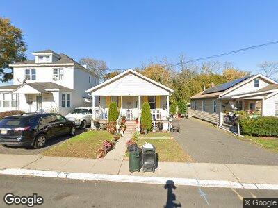
193 Joline Ave Long Branch, NJ 07740
Estimated Value: $373,000 - $416,000
2
Beds
1
Bath
881
Sq Ft
$448/Sq Ft
Est. Value
About This Home
This home is located at 193 Joline Ave, Long Branch, NJ 07740 and is currently estimated at $394,648, approximately $447 per square foot. 193 Joline Ave is a home located in Monmouth County with nearby schools including Long Branch High School and Holy Trinity School.
Ownership History
Date
Name
Owned For
Owner Type
Purchase Details
Closed on
Nov 21, 2013
Sold by
628 Chestnut Llc
Bought by
Nieto Efren Leon and Nieto Maria H
Current Estimated Value
Home Financials for this Owner
Home Financials are based on the most recent Mortgage that was taken out on this home.
Original Mortgage
$157,102
Outstanding Balance
$121,416
Interest Rate
4.4%
Mortgage Type
FHA
Estimated Equity
$278,283
Purchase Details
Closed on
Feb 7, 2012
Sold by
Wells Fargo Bank Na
Bought by
628 Chestnut Llc
Create a Home Valuation Report for This Property
The Home Valuation Report is an in-depth analysis detailing your home's value as well as a comparison with similar homes in the area
Home Values in the Area
Average Home Value in this Area
Purchase History
| Date | Buyer | Sale Price | Title Company |
|---|---|---|---|
| Nieto Efren Leon | $160,000 | Agent For Old Republic | |
| 628 Chestnut Llc | $65,000 | None Available |
Source: Public Records
Mortgage History
| Date | Status | Borrower | Loan Amount |
|---|---|---|---|
| Open | Nieto Efren Leon | $157,102 | |
| Previous Owner | Figueroa Nancy | $220,000 | |
| Previous Owner | Figueroa Nancy | $206,000 | |
| Previous Owner | Figueroa Leslie | $174,250 |
Source: Public Records
Tax History Compared to Growth
Tax History
| Year | Tax Paid | Tax Assessment Tax Assessment Total Assessment is a certain percentage of the fair market value that is determined by local assessors to be the total taxable value of land and additions on the property. | Land | Improvement |
|---|---|---|---|---|
| 2024 | $4,608 | $338,800 | $204,000 | $134,800 |
| 2023 | $4,608 | $296,700 | $168,000 | $128,700 |
| 2022 | $3,888 | $233,100 | $121,300 | $111,800 |
| 2021 | $3,888 | $194,300 | $89,800 | $104,500 |
| 2020 | $3,804 | $182,000 | $78,100 | $103,900 |
| 2019 | $3,649 | $173,600 | $74,500 | $99,100 |
| 2018 | $3,556 | $168,200 | $72,700 | $95,500 |
| 2017 | $3,392 | $164,600 | $70,900 | $93,700 |
| 2016 | $3,476 | $172,000 | $80,800 | $91,200 |
| 2015 | $2,474 | $111,100 | $49,300 | $61,800 |
| 2014 | $2,485 | $117,600 | $62,800 | $54,800 |
Source: Public Records
Map
Nearby Homes
- 227 Liberty St
- 230 Hamilton Ave
- 140 Joline Ave
- 333-335 Joline Ave
- 172 Chelton Ave
- 118 Joline Ave
- 138 Sampson Place
- 129 Joline Ave
- 323 Florence Ave
- 142 Rosewood Ave
- 184 N 5th Ave
- 40 Seaview Ave Unit A
- 18 Seaview Ave
- 205 Sixth Ave Unit 3
- 52 Liberty St
- 200 Ocean Ave N Unit 17
- 200 Ocean Ave N Unit 18
- 200 Ocean Ave N Unit 25
- 200 Ocean Ave N Unit 26
- 432 Ocean Blvd Unit 405