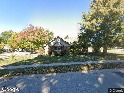
1932 Clay Dr Liberty, MO 64068
Estimated Value: $332,388 - $360,000
3
Beds
3
Baths
1,544
Sq Ft
$226/Sq Ft
Est. Value
About This Home
This home is located at 1932 Clay Dr, Liberty, MO 64068 and is currently estimated at $349,097, approximately $226 per square foot. 1932 Clay Dr is a home located in Clay County with nearby schools including Alexander Doniphan Elementary School, Discovery Middle School, and Liberty High School.
Ownership History
Date
Name
Owned For
Owner Type
Purchase Details
Closed on
Nov 21, 2017
Sold by
Tempero Preston E and Tempero Libeth B
Bought by
Tempero Preston E and Tempero Libeth B
Current Estimated Value
Purchase Details
Closed on
Jul 26, 2004
Sold by
Gugler Steven K and Gugler Sheila K
Bought by
Tempero Preston and Tempero Libeth
Home Financials for this Owner
Home Financials are based on the most recent Mortgage that was taken out on this home.
Original Mortgage
$160,800
Outstanding Balance
$85,218
Interest Rate
6.3%
Mortgage Type
Purchase Money Mortgage
Estimated Equity
$269,112
Purchase Details
Closed on
Feb 10, 2003
Sold by
Lueckert Richard B and Lueckert Nan Marie
Bought by
Resa Brandi N
Home Financials for this Owner
Home Financials are based on the most recent Mortgage that was taken out on this home.
Original Mortgage
$118,750
Interest Rate
5.9%
Create a Home Valuation Report for This Property
The Home Valuation Report is an in-depth analysis detailing your home's value as well as a comparison with similar homes in the area
Home Values in the Area
Average Home Value in this Area
Purchase History
| Date | Buyer | Sale Price | Title Company |
|---|---|---|---|
| Tempero Preston E | -- | None Available | |
| Tempero Preston | -- | United Title Company Inc | |
| Resa Brandi N | -- | Thomson Title Corporation |
Source: Public Records
Mortgage History
| Date | Status | Borrower | Loan Amount |
|---|---|---|---|
| Open | Tempero Preston | $160,800 | |
| Previous Owner | Resa Brandi N | $118,750 |
Source: Public Records
Tax History Compared to Growth
Tax History
| Year | Tax Paid | Tax Assessment Tax Assessment Total Assessment is a certain percentage of the fair market value that is determined by local assessors to be the total taxable value of land and additions on the property. | Land | Improvement |
|---|---|---|---|---|
| 2024 | $3,799 | $49,400 | -- | -- |
| 2023 | $3,864 | $49,400 | $0 | $0 |
| 2022 | $3,527 | $44,520 | $0 | $0 |
| 2021 | $3,499 | $44,517 | $7,220 | $37,297 |
| 2020 | $3,281 | $39,200 | $0 | $0 |
| 2019 | $3,280 | $39,200 | $0 | $0 |
| 2018 | $3,122 | $36,630 | $0 | $0 |
| 2017 | $2,688 | $36,630 | $4,180 | $32,450 |
| 2016 | $2,688 | $31,820 | $4,180 | $27,640 |
| 2015 | $2,688 | $31,820 | $4,180 | $27,640 |
| 2014 | $2,649 | $31,120 | $4,750 | $26,370 |
Source: Public Records
Map
Nearby Homes
- 1721 Windsor Ln
- 1801 Dunwich Ct
- 509 Belmont St
- 313 Belmont St
- 301 Wilshire Blvd
- 323 Glendale Rd
- 1008 Bristol Way
- 1500 Baker St
- 317 Southbrook St
- 204 Lake Ave
- 1320 Hillary Dr
- 940 Dunwich Dr
- 2116 Winding Woods Dr
- 708 Riverwood Dr
- Lot 2 Bent Oaks Dr
- Lot 2A Oak Crest Dr
- 402 Campbell Drive Ct
- 809 Kingston Ct
- 1504 Thompson Ave
- 1178 Huntington Dr