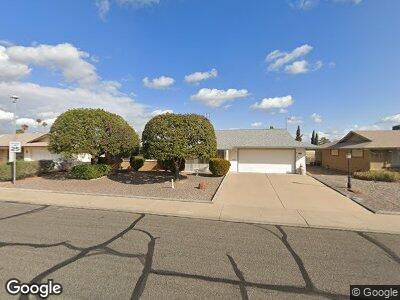
19437 N 99th Dr Unit 49 Sun City, AZ 85373
Estimated Value: $297,476 - $379,000
--
Bed
2
Baths
1,754
Sq Ft
$197/Sq Ft
Est. Value
About This Home
This home is located at 19437 N 99th Dr Unit 49, Sun City, AZ 85373 and is currently estimated at $346,119, approximately $197 per square foot. 19437 N 99th Dr Unit 49 is a home located in Maricopa County with nearby schools including Parkridge Elementary School, Sunrise Mountain High School, and Sonoran Science Academy-Peoria.
Ownership History
Date
Name
Owned For
Owner Type
Purchase Details
Closed on
Jan 25, 2013
Sold by
Mcclain Pamela
Bought by
Mcclain Teunis F
Current Estimated Value
Home Financials for this Owner
Home Financials are based on the most recent Mortgage that was taken out on this home.
Original Mortgage
$114,300
Outstanding Balance
$82,379
Interest Rate
3.33%
Mortgage Type
VA
Estimated Equity
$249,052
Purchase Details
Closed on
Mar 11, 2002
Sold by
Kershaw Esther Alice M and The George H & Esther M Kersha
Bought by
Mcclain Teunis F and Pope Pamela
Home Financials for this Owner
Home Financials are based on the most recent Mortgage that was taken out on this home.
Original Mortgage
$86,300
Interest Rate
6.84%
Mortgage Type
New Conventional
Create a Home Valuation Report for This Property
The Home Valuation Report is an in-depth analysis detailing your home's value as well as a comparison with similar homes in the area
Home Values in the Area
Average Home Value in this Area
Purchase History
| Date | Buyer | Sale Price | Title Company |
|---|---|---|---|
| Mcclain Teunis F | -- | Great American Title Agency | |
| Mcclain Teunis F | $107,900 | First American Title |
Source: Public Records
Mortgage History
| Date | Status | Borrower | Loan Amount |
|---|---|---|---|
| Open | Mcclain Teunis F | $114,300 | |
| Closed | Mcclain Teunis F | $17,000 | |
| Closed | Mcclain Teunis F | $86,300 | |
| Closed | Mcclain Teunis F | $86,300 | |
| Closed | Mcclain Teunis F | $10,800 |
Source: Public Records
Tax History Compared to Growth
Tax History
| Year | Tax Paid | Tax Assessment Tax Assessment Total Assessment is a certain percentage of the fair market value that is determined by local assessors to be the total taxable value of land and additions on the property. | Land | Improvement |
|---|---|---|---|---|
| 2025 | $1,190 | $15,256 | -- | -- |
| 2024 | $1,103 | $14,530 | -- | -- |
| 2023 | $1,103 | $24,580 | $4,910 | $19,670 |
| 2022 | $1,044 | $19,450 | $3,890 | $15,560 |
| 2021 | $1,078 | $18,370 | $3,670 | $14,700 |
| 2020 | $1,049 | $16,330 | $3,260 | $13,070 |
| 2019 | $1,035 | $15,450 | $3,090 | $12,360 |
| 2018 | $996 | $13,970 | $2,790 | $11,180 |
| 2017 | $960 | $12,470 | $2,490 | $9,980 |
| 2016 | $898 | $11,830 | $2,360 | $9,470 |
| 2015 | $857 | $10,860 | $2,170 | $8,690 |
Source: Public Records
Map
Nearby Homes
- 19825 N Sombrero Cir
- 20026 N Signal Butte Cir
- 20006 N Concho Cir
- 10103 W Saddle Ridge Dr
- 10118 W Concho Cir
- 19053 N Lakeforest Dr
- 19613 N Signal Butte Cir
- 10125 W Chaparral Dr
- 10414 W Ponderosa Cir
- 19825 N 100th Ave
- 19826 N Lake Forest Dr
- 19202 N Signal Butte Cir
- 19829 N Lake Forest Dr
- 19046 N Signal Butte Cir
- 19820 N Cherry Tree Ln
- 10421 W Signal Butte Cir
- 20006 N Palo Verde Dr
- 10609 W Concho Cir
- 10321 W Pine Springs Dr
- 20022 N Pine Springs Dr