19501 Pond Meadow Ave Bend, OR 97702
Southwest Bend NeighborhoodEstimated Value: $816,044 - $1,423,000
3
Beds
3
Baths
1,944
Sq Ft
$506/Sq Ft
Est. Value
About This Home
This home is located at 19501 Pond Meadow Ave, Bend, OR 97702 and is currently estimated at $983,011, approximately $505 per square foot. 19501 Pond Meadow Ave is a home located in Deschutes County with nearby schools including Elk Meadow Elementary School, Cascade Middle School, and Summit High School.
Ownership History
Date
Name
Owned For
Owner Type
Purchase Details
Closed on
Nov 30, 2021
Sold by
Smith Allen Sterling
Bought by
Smith Cory M and Smith Ryan C
Current Estimated Value
Purchase Details
Closed on
Oct 20, 2011
Sold by
Smith Allen S and Smith Frances H
Bought by
Smith Allen Sterling and Smith Frances Hazel
Purchase Details
Closed on
Dec 5, 2007
Sold by
Hendrickson Homes Of Oregon Llc
Bought by
Smith Allen S and Smith Frances H
Home Financials for this Owner
Home Financials are based on the most recent Mortgage that was taken out on this home.
Original Mortgage
$341,420
Outstanding Balance
$220,818
Interest Rate
6.12%
Mortgage Type
Unknown
Estimated Equity
$762,193
Purchase Details
Closed on
Feb 2, 2006
Sold by
Nnp Riverrim Llc
Bought by
Hendrickson Homes Of Oregon Llc
Create a Home Valuation Report for This Property
The Home Valuation Report is an in-depth analysis detailing your home's value as well as a comparison with similar homes in the area
Home Values in the Area
Average Home Value in this Area
Purchase History
| Date | Buyer | Sale Price | Title Company |
|---|---|---|---|
| Smith Allen Sterling | -- | None Available | |
| Smith Allen Sterling | -- | None Available | |
| Smith Allen S | $426,777 | First Amer Title Ins Co Or | |
| Hendrickson Homes Of Oregon Llc | $76,838 | Amerititle |
Source: Public Records
Mortgage History
| Date | Status | Borrower | Loan Amount |
|---|---|---|---|
| Open | Smith Allen Sterling | $150,000 | |
| Closed | Smith Allen | $149,000 | |
| Open | Smith Allen S | $341,420 | |
| Previous Owner | Hendrickson Homes Of Oregon Llc | $264,057 |
Source: Public Records
Tax History Compared to Growth
Tax History
| Year | Tax Paid | Tax Assessment Tax Assessment Total Assessment is a certain percentage of the fair market value that is determined by local assessors to be the total taxable value of land and additions on the property. | Land | Improvement |
|---|---|---|---|---|
| 2024 | $4,652 | $277,830 | -- | -- |
| 2023 | $4,312 | $269,740 | $0 | $0 |
| 2022 | $4,023 | $254,270 | $0 | $0 |
| 2021 | $4,030 | $246,870 | $0 | $0 |
| 2020 | $3,823 | $246,870 | $0 | $0 |
| 2019 | $3,716 | $239,680 | $0 | $0 |
| 2018 | $3,611 | $232,700 | $0 | $0 |
| 2017 | $3,506 | $225,930 | $0 | $0 |
| 2016 | $3,343 | $219,350 | $0 | $0 |
| 2015 | $3,251 | $212,970 | $0 | $0 |
| 2014 | $3,155 | $206,770 | $0 | $0 |
Source: Public Records
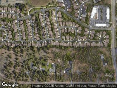
Map
Nearby Homes
- 19550 Buck Canyon Rd
- 60832 Scotts Bluff Place
- 19575 Buck Canyon Rd
- 60879 Garrison Dr
- 60933 Clearmeadow Ct
- 60898 Garrison Dr
- 19555 Greatwood Loop
- 19646 Nugget Place
- 60860 SW Deer Creek Place
- 60647 Antler Rd
- 60985 Snowbrush Dr
- 19750 Poplar St
- 61007 Snowberry Place
- 60979 Targee Dr
- 19760 Poplar St
- 61054 Chamomile Place
- 60903 Amethyst St
- 19703 Carm Ln
- 61075 Chuckanut Dr
- 19494 Baker Rd