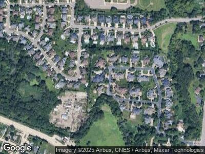
19766 Westchester Dr Clinton Township, MI 48038
Clinton Township NeighborhoodEstimated Value: $1,254,000 - $2,252,000
--
Bed
5
Baths
8,947
Sq Ft
$186/Sq Ft
Est. Value
About This Home
This home is located at 19766 Westchester Dr, Clinton Township, MI 48038 and is currently estimated at $1,660,549, approximately $185 per square foot. 19766 Westchester Dr is a home located in Macomb County with nearby schools including Cherokee Elementary School, Wyandot Middle School, and Chippewa Valley High School.
Ownership History
Date
Name
Owned For
Owner Type
Purchase Details
Closed on
Dec 19, 2006
Sold by
Mathers Kimberley A
Bought by
Mathers Marshall Bruce
Current Estimated Value
Purchase Details
Closed on
Aug 31, 2000
Sold by
Jeffrey Hudock
Bought by
Marshall Mathers
Purchase Details
Closed on
Aug 29, 1995
Sold by
B & M Const Inc
Bought by
Judock Jefferey and Judock Mary M
Create a Home Valuation Report for This Property
The Home Valuation Report is an in-depth analysis detailing your home's value as well as a comparison with similar homes in the area
Home Values in the Area
Average Home Value in this Area
Purchase History
| Date | Buyer | Sale Price | Title Company |
|---|---|---|---|
| Mathers Marshall Bruce | -- | None Available | |
| Marshall Mathers | $1,483,500 | -- | |
| Judock Jefferey | $892,700 | -- |
Source: Public Records
Mortgage History
| Date | Status | Borrower | Loan Amount |
|---|---|---|---|
| Previous Owner | Mathers Marshall Bruce | $599,500 |
Source: Public Records
Tax History Compared to Growth
Tax History
| Year | Tax Paid | Tax Assessment Tax Assessment Total Assessment is a certain percentage of the fair market value that is determined by local assessors to be the total taxable value of land and additions on the property. | Land | Improvement |
|---|---|---|---|---|
| 2024 | $17,263 | $687,800 | $0 | $0 |
| 2023 | $16,633 | $665,400 | $0 | $0 |
| 2022 | $27,164 | $676,300 | $0 | $0 |
| 2021 | $26,418 | $669,500 | $0 | $0 |
| 2020 | $15,543 | $712,900 | $0 | $0 |
| 2019 | $24,608 | $747,700 | $0 | $0 |
| 2018 | $24,100 | $728,800 | $0 | $0 |
| 2017 | $23,883 | $668,700 | $169,400 | $499,300 |
| 2016 | $23,733 | $668,700 | $0 | $0 |
| 2015 | -- | $620,800 | $0 | $0 |
| 2014 | -- | $593,200 | $0 | $0 |
| 2011 | -- | $567,600 | $78,700 | $488,900 |
Source: Public Records
Map
Nearby Homes
- 20310 Drummond Bay
- 41800 Heydenreich Rd
- 43331 Herring Dr
- 43581 Salt Creek Dr
- 42040 Dorchester Ct Unit 9
- 42926 Ian Ct
- 20559 Brandonwood Dr
- 41268 Rugosa Dr
- 43662 Welland Dr
- 42266 Brookview Ln
- 43036 Biland Dr
- 43414 Devin Dr
- 44130 Cadburry Dr
- 40938 E Rosewood Dr
- 19059 Fortuna Dr S
- 42229 Spruce Ln
- 42201 Hidden Brook Dr Unit 68
- 40966 Harvest Ln Unit Bldg 4 Unit 13
- 18455 Cranbrook Dr
- 44263 Ausable Dr
