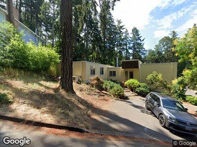
1980 Kimberly Dr Eugene, OR 97405
Southeast Eugene NeighborhoodEstimated Value: $779,000 - $893,000
4
Beds
3
Baths
2,911
Sq Ft
$289/Sq Ft
Est. Value
About This Home
This home is located at 1980 Kimberly Dr, Eugene, OR 97405 and is currently estimated at $840,964, approximately $288 per square foot. 1980 Kimberly Dr is a home located in Lane County with nearby schools including Camas Ridge Community Elementary School, Roosevelt Middle School, and South Eugene High School.
Ownership History
Date
Name
Owned For
Owner Type
Purchase Details
Closed on
Dec 15, 2015
Sold by
Morrow Ray Wilson and Morrow Phyllis A
Bought by
Niesley Joseph Bruce and Niesley Michelle
Current Estimated Value
Purchase Details
Closed on
Mar 5, 1999
Sold by
Morrow Phyllis A
Bought by
Morrow Ray Wilson and Morrow Phyllis A
Home Financials for this Owner
Home Financials are based on the most recent Mortgage that was taken out on this home.
Original Mortgage
$240,000
Interest Rate
6.7%
Create a Home Valuation Report for This Property
The Home Valuation Report is an in-depth analysis detailing your home's value as well as a comparison with similar homes in the area
Home Values in the Area
Average Home Value in this Area
Purchase History
| Date | Buyer | Sale Price | Title Company |
|---|---|---|---|
| Niesley Joseph Bruce | $372,000 | Cascade Title Company |
Source: Public Records
Mortgage History
| Date | Status | Borrower | Loan Amount |
|---|---|---|---|
| Open | Niesley Joseph Bruce | $100,000 | |
| Open | Niesley Joseph Bruce | $300,000 | |
| Closed | Niesley Joseph Bruce | $75,000 | |
| Previous Owner | Morrow Ray Wilson | $125,800 | |
| Previous Owner | Morrow Ray Wilson | $119,500 | |
| Previous Owner | Morrow Ray Wilson | $240,000 |
Source: Public Records
Tax History Compared to Growth
Tax History
| Year | Tax Paid | Tax Assessment Tax Assessment Total Assessment is a certain percentage of the fair market value that is determined by local assessors to be the total taxable value of land and additions on the property. | Land | Improvement |
|---|---|---|---|---|
| 2023 | $9,213 | $451,347 | $0 | $0 |
| 2022 | $8,631 | $438,201 | $0 | $0 |
| 2021 | $7,928 | $425,438 | $0 | $0 |
| 2020 | $7,734 | $413,047 | $0 | $0 |
| 2019 | $7,521 | $401,017 | $0 | $0 |
| 2018 | $7,014 | $377,997 | $0 | $0 |
| 2017 | $6,546 | $377,997 | $0 | $0 |
| 2016 | $6,323 | $366,987 | $0 | $0 |
| 2015 | $6,139 | $356,298 | $0 | $0 |
| 2014 | $6,057 | $345,920 | $0 | $0 |
Source: Public Records
Map
Nearby Homes
- 0000 Spring Blvd Unit 2500
- 1700 Cameo Dr
- 1947 Woodson Loop
- 3777 Vine Maple St
- 3210 Agate St
- 2082 Golfview Ct
- 3710 Emerald St
- 0 E 38th Ave
- 3680 Potter St
- 0 N Shasta Loop Unit 23633126
- 1731 Estate Dr
- 3740 Potter St
- 3175 Potter St
- 3797 Kincaid St
- 2810 Capital Dr
- 3735 E Amazon Dr
- 1085 Cannon Ct
- 3717 E Amazon Dr
- 3621 E Amazon Dr
- 3145 Nob Ct