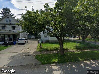
2005 Pointview Ave Youngstown, OH 44502
Buckeye Plat NeighborhoodEstimated Value: $50,265 - $74,000
2
Beds
1
Bath
960
Sq Ft
$66/Sq Ft
Est. Value
About This Home
This home is located at 2005 Pointview Ave, Youngstown, OH 44502 and is currently estimated at $63,066, approximately $65 per square foot. 2005 Pointview Ave is a home located in Mahoning County with nearby schools including Paul C. Bunn Elementary School, Chaney High School, and Summit Academy Secondary School - Youngstown.
Ownership History
Date
Name
Owned For
Owner Type
Purchase Details
Closed on
Dec 21, 1994
Sold by
Hallos James T
Bought by
Berndt John
Current Estimated Value
Home Financials for this Owner
Home Financials are based on the most recent Mortgage that was taken out on this home.
Original Mortgage
$15,300
Interest Rate
7.75%
Mortgage Type
New Conventional
Purchase Details
Closed on
Mar 31, 1992
Bought by
Hallos James T
Create a Home Valuation Report for This Property
The Home Valuation Report is an in-depth analysis detailing your home's value as well as a comparison with similar homes in the area
Home Values in the Area
Average Home Value in this Area
Purchase History
| Date | Buyer | Sale Price | Title Company |
|---|---|---|---|
| Berndt John | $19,125 | -- | |
| Hallos James T | -- | -- |
Source: Public Records
Mortgage History
| Date | Status | Borrower | Loan Amount |
|---|---|---|---|
| Closed | Berndt John | $15,300 |
Source: Public Records
Tax History Compared to Growth
Tax History
| Year | Tax Paid | Tax Assessment Tax Assessment Total Assessment is a certain percentage of the fair market value that is determined by local assessors to be the total taxable value of land and additions on the property. | Land | Improvement |
|---|---|---|---|---|
| 2024 | $292 | $5,930 | $830 | $5,100 |
| 2023 | $290 | $5,930 | $830 | $5,100 |
| 2022 | $268 | $4,220 | $830 | $3,390 |
| 2021 | $268 | $4,220 | $830 | $3,390 |
| 2020 | $270 | $4,220 | $830 | $3,390 |
| 2019 | $276 | $3,840 | $760 | $3,080 |
| 2018 | $279 | $3,840 | $760 | $3,080 |
| 2017 | $276 | $3,840 | $760 | $3,080 |
| 2016 | $506 | $7,620 | $760 | $6,860 |
| 2015 | $496 | $7,620 | $760 | $6,860 |
| 2014 | $493 | $7,620 | $760 | $6,860 |
| 2013 | $486 | $7,620 | $760 | $6,860 |
Source: Public Records
Map
Nearby Homes
- 2018 S Heights Ave
- 3628 Irma St
- 3508 Loveland Rd
- 1658 Weston Ave
- 3515 Lasalle Ave
- 414 10th St
- 2510 E Midlothian Blvd
- 3337 Powers Way
- 1641 Medford Ave
- 1605 Medford Ave
- 4427 Sheridan Rd
- 1617 Brownlee Ave
- 1666 Bancroft Ave
- 1533 Weston Ave
- 1559 Wakefield Ave
- 1677 Chattanooga Ave
- 1351 E Boston Ave
- 2100 Lynn Ave
- 1146 Detroit Ave
- 1350 E Florida Ave