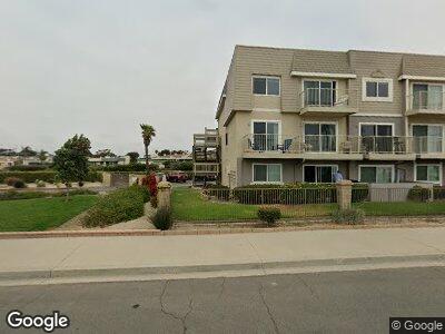
201 E Surfside Dr Port Hueneme, CA 93041
Estimated Value: $479,000 - $658,000
2
Beds
2
Baths
933
Sq Ft
$596/Sq Ft
Est. Value
About This Home
This home is located at 201 E Surfside Dr, Port Hueneme, CA 93041 and is currently estimated at $555,611, approximately $595 per square foot. 201 E Surfside Dr is a home located in Ventura County with nearby schools including Hueneme Elementary, Hueneme High School, and St. Anthony's Elementary School.
Ownership History
Date
Name
Owned For
Owner Type
Purchase Details
Closed on
Sep 10, 2024
Sold by
Toovy Barbara
Bought by
Samuel Toovy And Barbara Toovy Living Trust and Toovy
Current Estimated Value
Purchase Details
Closed on
Apr 27, 1995
Sold by
Toovy Samuel and Toovy Barbara
Bought by
Toovy Samuel and Toovy Barbara
Home Financials for this Owner
Home Financials are based on the most recent Mortgage that was taken out on this home.
Original Mortgage
$78,000
Interest Rate
8.44%
Purchase Details
Closed on
Jul 12, 1994
Sold by
Mori Dennis Shigeki
Bought by
Toovy Samuel and Toovy Barbara
Home Financials for this Owner
Home Financials are based on the most recent Mortgage that was taken out on this home.
Original Mortgage
$84,000
Interest Rate
8.8%
Create a Home Valuation Report for This Property
The Home Valuation Report is an in-depth analysis detailing your home's value as well as a comparison with similar homes in the area
Home Values in the Area
Average Home Value in this Area
Purchase History
| Date | Buyer | Sale Price | Title Company |
|---|---|---|---|
| Samuel Toovy And Barbara Toovy Living Trust | -- | None Listed On Document | |
| Toovy Samuel | -- | Chicago Title Co | |
| Toovy Samuel | $105,000 | Chicago Title Co |
Source: Public Records
Mortgage History
| Date | Status | Borrower | Loan Amount |
|---|---|---|---|
| Previous Owner | Toovy Samuel | $78,000 | |
| Previous Owner | Toovy Samuel | $84,000 |
Source: Public Records
Tax History Compared to Growth
Tax History
| Year | Tax Paid | Tax Assessment Tax Assessment Total Assessment is a certain percentage of the fair market value that is determined by local assessors to be the total taxable value of land and additions on the property. | Land | Improvement |
|---|---|---|---|---|
| 2024 | $990 | $72,637 | $33,895 | $38,742 |
| 2023 | $946 | $71,213 | $33,230 | $37,983 |
| 2022 | $923 | $69,817 | $32,578 | $37,239 |
| 2021 | $922 | $68,449 | $31,940 | $36,509 |
| 2020 | $913 | $67,749 | $31,613 | $36,136 |
| 2019 | $901 | $66,422 | $30,994 | $35,428 |
| 2018 | $875 | $65,121 | $30,387 | $34,734 |
| 2017 | $847 | $63,845 | $29,792 | $34,053 |
| 2016 | $825 | $62,594 | $29,208 | $33,386 |
| 2015 | $808 | $61,656 | $28,770 | $32,886 |
| 2014 | $801 | $60,450 | $28,207 | $32,243 |
Source: Public Records
Map
Nearby Homes
- 240 E Surfside Dr
- 263 S Ventura Rd Unit 265
- 225 S Ventura Rd Unit 79
- 385 E Surfside Dr
- 201 S Ventura Rd Unit 6
- 570 Terrace View Place
- 588 Island View Cir
- 420 Village Rd
- 630 Island View Cir
- 233 N 3rd St
- 750 Island View Cir
- 772 Island View Cir
- 340 Ponoma St
- 631 Beachport Dr
- 306 Blue Dolphin Dr
- 667 Ocean View Dr
- 522 Ebbtide Cir
- 566 Ebbtide Cir
- 683 Reef Cir
- 520 Sanddollar Ln