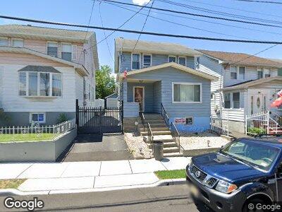
2010 Kay Ave Union, NJ 07083
Union Township NeighborhoodEstimated Value: $184,379 - $514,000
--
Bed
--
Bath
1
Sq Ft
$417,345/Sq Ft
Est. Value
About This Home
This home is located at 2010 Kay Ave, Union, NJ 07083 and is currently estimated at $417,345, approximately $417,345 per square foot. 2010 Kay Ave is a home located in Union County with nearby schools including Franklin Elementary School, Burnet Middle School, and Union High School.
Ownership History
Date
Name
Owned For
Owner Type
Purchase Details
Closed on
Jan 3, 2013
Sold by
Dasilva Susete Candido and Dasilva Benjamin
Bought by
Dasilva Susete Candido and Dasilva Benjamin
Current Estimated Value
Home Financials for this Owner
Home Financials are based on the most recent Mortgage that was taken out on this home.
Original Mortgage
$157,050
Outstanding Balance
$113,483
Interest Rate
3.39%
Mortgage Type
New Conventional
Estimated Equity
$284,762
Create a Home Valuation Report for This Property
The Home Valuation Report is an in-depth analysis detailing your home's value as well as a comparison with similar homes in the area
Home Values in the Area
Average Home Value in this Area
Purchase History
| Date | Buyer | Sale Price | Title Company |
|---|---|---|---|
| Dasilva Susete Candido | -- | None Available |
Source: Public Records
Mortgage History
| Date | Status | Borrower | Loan Amount |
|---|---|---|---|
| Open | Silva Susete Da | $66,000 | |
| Open | Silva Susete Candido Da | $157,050 | |
| Closed | Silva Susete Candido De | $30,000 | |
| Previous Owner | Silva Benjamin Da | $39,600 | |
| Previous Owner | Dasilva Benjamin | $186,000 |
Source: Public Records
Tax History Compared to Growth
Tax History
| Year | Tax Paid | Tax Assessment Tax Assessment Total Assessment is a certain percentage of the fair market value that is determined by local assessors to be the total taxable value of land and additions on the property. | Land | Improvement |
|---|---|---|---|---|
| 2024 | $7,931 | $36,600 | $12,800 | $23,800 |
| 2023 | $7,931 | $36,600 | $12,800 | $23,800 |
| 2022 | $7,655 | $36,600 | $12,800 | $23,800 |
| 2021 | $7,470 | $36,600 | $12,800 | $23,800 |
| 2020 | $7,321 | $36,600 | $12,800 | $23,800 |
| 2019 | $7,222 | $36,600 | $12,800 | $23,800 |
| 2018 | $7,099 | $36,600 | $12,800 | $23,800 |
| 2017 | $6,994 | $36,600 | $12,800 | $23,800 |
| 2016 | $6,824 | $36,600 | $12,800 | $23,800 |
| 2015 | $6,711 | $36,600 | $12,800 | $23,800 |
| 2014 | $6,560 | $36,600 | $12,800 | $23,800 |
Source: Public Records
Map
Nearby Homes
- 1314 Barbara Ave
- 2025 High St
- 2011 Tyler St
- 1263 Coolidge Ave
- 1836 Long Terrace
- 1869 Cider Mill Rd
- 1905 Oakwood Pkwy
- 1284 Shetland Dr
- 1248 Schmidt Ave
- 2225 Stecher Ave
- 1138 Caldwell Ave
- 1563 Walker Ave
- 1012 Pine Ave
- 987 Floyd Terrace
- 9 Cleveland Rd
- 951 Grandview Ave
- 1156 Woolley Ave
- 2291 Morrison Ave
- 1475 Walker Ave
- 1380 Omara Dr