Estimated Value: $129,000 - $183,000
3
Beds
1
Bath
1,120
Sq Ft
$138/Sq Ft
Est. Value
About This Home
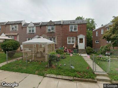
This home is located at 202 Golf Rd, Darby, PA 19023 and is currently estimated at $154,674, approximately $138 per square foot. 202 Golf Rd is a home located in Delaware County with nearby schools including Park Lane Elementary School, Penn Wood Middle School, and Penn Wood High School - Cypress Street Campus.
Ownership History
Date
Name
Owned For
Owner Type
Purchase Details
Closed on
Feb 9, 2022
Sold by
Vincenzo Testa
Bought by
Dhda Llc
Current Estimated Value
Purchase Details
Closed on
May 8, 2006
Sold by
Roller Fannin Judith M
Bought by
Testa Vincenzo and Testa Antoinetta
Home Financials for this Owner
Home Financials are based on the most recent Mortgage that was taken out on this home.
Original Mortgage
$66,400
Interest Rate
8.12%
Mortgage Type
Purchase Money Mortgage
Purchase Details
Closed on
Jun 24, 2004
Sold by
Lynch John James and Lynch Judith Anne
Bought by
Roller Fannin Judith M
Home Financials for this Owner
Home Financials are based on the most recent Mortgage that was taken out on this home.
Original Mortgage
$53,100
Interest Rate
6.32%
Mortgage Type
Fannie Mae Freddie Mac
Create a Home Valuation Report for This Property
The Home Valuation Report is an in-depth analysis detailing your home's value as well as a comparison with similar homes in the area
Home Values in the Area
Average Home Value in this Area
Purchase History
| Date | Buyer | Sale Price | Title Company |
|---|---|---|---|
| Dhda Llc | $96,000 | None Listed On Document | |
| Testa Vincenzo | $83,000 | None Available | |
| Roller Fannin Judith M | $59,000 | -- |
Source: Public Records
Mortgage History
| Date | Status | Borrower | Loan Amount |
|---|---|---|---|
| Open | Dhda Llc | $118,000 | |
| Open | Dhda Llc | $1,418,200 | |
| Previous Owner | Testa Vincenzo | $66,400 | |
| Previous Owner | Roller Fannin Judith M | $53,100 |
Source: Public Records
Tax History Compared to Growth
Tax History
| Year | Tax Paid | Tax Assessment Tax Assessment Total Assessment is a certain percentage of the fair market value that is determined by local assessors to be the total taxable value of land and additions on the property. | Land | Improvement |
|---|---|---|---|---|
| 2024 | $3,155 | $63,720 | $18,740 | $44,980 |
| 2023 | $2,969 | $63,720 | $18,740 | $44,980 |
| 2022 | $2,888 | $63,720 | $18,740 | $44,980 |
| 2021 | $4,030 | $63,720 | $18,740 | $44,980 |
| 2020 | $3,734 | $51,120 | $15,190 | $35,930 |
| 2019 | $3,576 | $51,120 | $15,190 | $35,930 |
| 2018 | $3,532 | $51,120 | $0 | $0 |
| 2017 | $3,468 | $51,120 | $0 | $0 |
| 2016 | $286 | $51,120 | $0 | $0 |
| 2015 | $286 | $51,120 | $0 | $0 |
| 2014 | $281 | $51,120 | $0 | $0 |
Source: Public Records
Map
Nearby Homes
- 1328 Wycombe Ave
- 1246 Wycombe Ave
- 44 Branford Rd
- 1237 Edgehill Rd
- 109 Weymouth Rd
- 1010 Summit St
- 54 N Macdade Blvd
- 925 Maple Terrace
- 0 Marks Ave
- 226 Marks Ave
- 311 N 9th St
- 174 Park Place
- 908 Cedar Ave
- 221 N 9th St
- 1107 Crestview Rd
- 749 Fern St
- 1007 Tyler Ave
- 14 Winthrop Rd
- 741 Cricket Ln
- 116 Bartram Ave