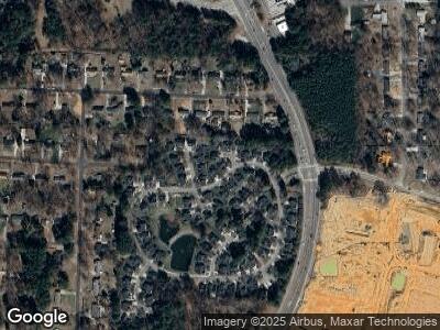
202 Latta Cir Durham, NC 27712
Latta Road NeighborhoodEstimated Value: $359,551 - $386,000
3
Beds
2
Baths
1,273
Sq Ft
$292/Sq Ft
Est. Value
About This Home
This home is located at 202 Latta Cir, Durham, NC 27712 and is currently estimated at $371,388, approximately $291 per square foot. 202 Latta Cir is a home located in Durham County with nearby schools including Hillandale Elementary School, George L Carrington Middle, and Riverside High School.
Ownership History
Date
Name
Owned For
Owner Type
Purchase Details
Closed on
Sep 12, 2015
Sold by
Aiken Aguinita B and Aiken Ronald
Bought by
Aiken Aguinita B and Aiken Ronald
Current Estimated Value
Home Financials for this Owner
Home Financials are based on the most recent Mortgage that was taken out on this home.
Original Mortgage
$119,000
Outstanding Balance
$95,337
Interest Rate
3.94%
Mortgage Type
New Conventional
Estimated Equity
$279,392
Purchase Details
Closed on
Mar 10, 1999
Sold by
The New Fortis Corp
Bought by
Aiken Aguinita B
Home Financials for this Owner
Home Financials are based on the most recent Mortgage that was taken out on this home.
Original Mortgage
$123,828
Interest Rate
10.05%
Create a Home Valuation Report for This Property
The Home Valuation Report is an in-depth analysis detailing your home's value as well as a comparison with similar homes in the area
Home Values in the Area
Average Home Value in this Area
Purchase History
| Date | Buyer | Sale Price | Title Company |
|---|---|---|---|
| Aiken Aguinita B | -- | Attorney | |
| Aiken Aguinita B | $137,500 | -- |
Source: Public Records
Mortgage History
| Date | Status | Borrower | Loan Amount |
|---|---|---|---|
| Open | Aiken Aguinita B | $119,000 | |
| Closed | Aiken Aguinita B | $131,500 | |
| Closed | Aiken Ronald | $127,500 | |
| Closed | Aiken Aguinita B | $123,828 |
Source: Public Records
Tax History Compared to Growth
Tax History
| Year | Tax Paid | Tax Assessment Tax Assessment Total Assessment is a certain percentage of the fair market value that is determined by local assessors to be the total taxable value of land and additions on the property. | Land | Improvement |
|---|---|---|---|---|
| 2024 | $2,735 | $196,083 | $34,080 | $162,003 |
| 2023 | $2,568 | $196,083 | $34,080 | $162,003 |
| 2022 | $2,510 | $196,083 | $34,080 | $162,003 |
| 2021 | $2,498 | $196,083 | $34,080 | $162,003 |
| 2020 | $2,439 | $196,083 | $34,080 | $162,003 |
| 2019 | $2,439 | $196,083 | $34,080 | $162,003 |
| 2018 | $2,289 | $168,752 | $31,240 | $137,512 |
| 2017 | $2,272 | $168,752 | $31,240 | $137,512 |
| 2016 | $2,196 | $168,752 | $31,240 | $137,512 |
| 2015 | $2,239 | $161,759 | $36,231 | $125,528 |
| 2014 | $2,239 | $161,759 | $36,231 | $125,528 |
Source: Public Records
Map
Nearby Homes
- 5002 Kendridge Dr
- 1813 Grady Dr
- 5013 Green Oak Dr
- 5033 Green Oak Dr
- 8 Queensland Ct
- 5130 Guess Rd
- 5026 Gatewood Dr
- 1204 Donphil Rd
- 5232 Guess Rd
- 1903 Yellowwood Ln
- 5929 Guess Rd
- 1908 Mystic Dr
- 5439 Ripplebrook Rd
- 4032 Chaucer Dr
- 4619 Paces Ferry Dr
- 7 Starwood Ln
- 109 Bessemer Place
- 4703 Paces Ferry Dr
- 2501 Landis Dr
- 2606 Landis Dr
