2020 SW Washburn Ave Topeka, KS 66604
Chesney Park NeighborhoodEstimated Value: $105,000 - $151,000
3
Beds
1
Bath
1,963
Sq Ft
$65/Sq Ft
Est. Value
About This Home
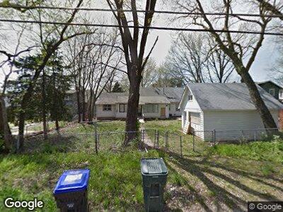
This home is located at 2020 SW Washburn Ave, Topeka, KS 66604 and is currently estimated at $127,218, approximately $64 per square foot. 2020 SW Washburn Ave is a home located in Shawnee County with nearby schools including Robinson Middle School, Topeka High School, and Mater Dei Catholic School.
Ownership History
Date
Name
Owned For
Owner Type
Purchase Details
Closed on
Feb 15, 2019
Sold by
Curtis Sherri M
Bought by
Amherst Holdings Llc
Current Estimated Value
Purchase Details
Closed on
Feb 5, 2019
Sold by
Bohannon Sean and Perry Stephanie
Bought by
Amherst Holdings Llc
Purchase Details
Closed on
Feb 9, 2011
Sold by
Gmac Mortgage Llc
Bought by
Curtis Sherri M and Bohannon Sean
Purchase Details
Closed on
Aug 30, 2010
Sold by
Sullivan Jason and Mortgage Electronic Registrati
Bought by
Gmac Mortgage Llc
Create a Home Valuation Report for This Property
The Home Valuation Report is an in-depth analysis detailing your home's value as well as a comparison with similar homes in the area
Home Values in the Area
Average Home Value in this Area
Purchase History
| Date | Buyer | Sale Price | Title Company |
|---|---|---|---|
| Amherst Holdings Llc | -- | Heartland Title | |
| Amherst Holdings Llc | -- | Heart Land Title | |
| Curtis Sherri M | -- | Kansas Secured Title | |
| Gmac Mortgage Llc | $40,500 | Continental Title |
Source: Public Records
Mortgage History
| Date | Status | Borrower | Loan Amount |
|---|---|---|---|
| Open | Amherst Holdings Llc | $34,400 | |
| Previous Owner | Sullivan Jason | $59,900 | |
| Previous Owner | Sullivan Jason | $15,000 |
Source: Public Records
Tax History Compared to Growth
Tax History
| Year | Tax Paid | Tax Assessment Tax Assessment Total Assessment is a certain percentage of the fair market value that is determined by local assessors to be the total taxable value of land and additions on the property. | Land | Improvement |
|---|---|---|---|---|
| 2023 | $1,370 | $9,773 | $0 | $0 |
| 2022 | $1,320 | $9,133 | $0 | $0 |
| 2021 | $1,283 | $8,303 | $0 | $0 |
| 2020 | $912 | $6,049 | $0 | $0 |
| 2019 | $786 | $5,223 | $0 | $0 |
| 2018 | $763 | $5,072 | $0 | $0 |
| 2017 | $764 | $5,072 | $0 | $0 |
| 2014 | $895 | $5,834 | $0 | $0 |
Source: Public Records
Map
Nearby Homes
- 2011 SW Lane St
- 2039 SW Lincoln St
- 2027 SW Clay St
- 2129 SW Buchanan St
- 1501-1599 SW 17th St
- 2212 SW Clay St
- 1541 SW 23rd Park
- 1234 SW 25th St
- 2240 SW Boswell Ct
- 2404 SW College Ave
- 2204 SW Fillmore St
- 1523 SW Mulvane St
- 2212 SW MacVicar Ave
- 2528 SW Clay St
- 2400 SW 23rd St
- 2627 SW Buchanan St
- 1842 SW High Ave
- 2701 SW Burlingame Rd
- 1310 SW 14th St
- 1335 SW Lincoln St