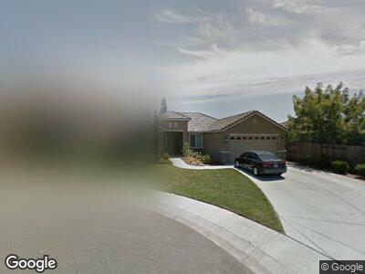
2033 Bristol Ct Yuba City, CA 95991
Outlying Yuba City NeighborhoodEstimated Value: $470,643 - $516,000
3
Beds
2
Baths
1,828
Sq Ft
$273/Sq Ft
Est. Value
About This Home
This home is located at 2033 Bristol Ct, Yuba City, CA 95991 and is currently estimated at $499,911, approximately $273 per square foot. 2033 Bristol Ct is a home located in Sutter County with nearby schools including April Lane Elementary School, Gray Avenue Middle School, and River Valley High School.
Ownership History
Date
Name
Owned For
Owner Type
Purchase Details
Closed on
Oct 27, 2011
Sold by
Interwest Homes Corp
Bought by
Heir Kummel
Current Estimated Value
Purchase Details
Closed on
Feb 10, 2011
Sold by
Scott James Ronald and Scott Rebecca Lynn
Bought by
Interwest Homes Corp
Purchase Details
Closed on
May 13, 2008
Sold by
Dunmore Canterbury Llc
Bought by
Guaranty Plus Properties Llc 2
Create a Home Valuation Report for This Property
The Home Valuation Report is an in-depth analysis detailing your home's value as well as a comparison with similar homes in the area
Home Values in the Area
Average Home Value in this Area
Purchase History
| Date | Buyer | Sale Price | Title Company |
|---|---|---|---|
| Heir Kummel | $236,000 | Placer Title Company | |
| Interwest Homes Corp | -- | None Available | |
| Guaranty Plus Properties Llc 2 | $9,524,000 | First American Title Ins Co |
Source: Public Records
Tax History Compared to Growth
Tax History
| Year | Tax Paid | Tax Assessment Tax Assessment Total Assessment is a certain percentage of the fair market value that is determined by local assessors to be the total taxable value of land and additions on the property. | Land | Improvement |
|---|---|---|---|---|
| 2023 | $4,662 | $284,668 | $42,250 | $242,418 |
| 2022 | $4,490 | $279,087 | $41,422 | $237,665 |
| 2021 | $4,439 | $273,624 | $40,614 | $233,010 |
| 2020 | $4,375 | $270,819 | $40,198 | $230,621 |
| 2019 | $4,299 | $265,509 | $39,410 | $226,099 |
| 2018 | $4,209 | $260,302 | $38,637 | $221,665 |
| 2017 | $4,128 | $255,197 | $37,879 | $217,318 |
| 2016 | $4,058 | $250,193 | $37,136 | $213,057 |
| 2015 | $3,999 | $246,435 | $36,579 | $209,856 |
| 2014 | $3,847 | $241,608 | $35,862 | $205,746 |
Source: Public Records
Map
Nearby Homes
- 2062 Westminster Dr
- 1961 Kaia Way
- 1962 Kaia Way
- 1931 Kaia Way
- 1921 Kaia Way
- 1951 Kaia Way
- W Onstott Frontage Rd & Pease Rd
- 2021 Gray Ave
- 2001 Pheasant Dr
- 1022 Skyline Dr
- 981 Northridge Dr
- 957 Northpointe Dr
- 1362 Jamie Dr
- 1151 Carlisle Way
- 1463 Pabla Ct
- 857 Oxford Ct
- 962 Heritage Way
- 1889 Tumber Way
- 2196 Cartagena Dr
- 1155 Pease Rd Unit 428