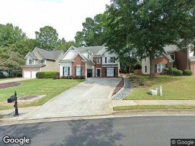
2095 Monroe Dr Alpharetta, GA 30004
Estimated Value: $604,000 - $663,000
4
Beds
3
Baths
2,313
Sq Ft
$272/Sq Ft
Est. Value
About This Home
This home is located at 2095 Monroe Dr, Alpharetta, GA 30004 and is currently estimated at $628,956, approximately $271 per square foot. 2095 Monroe Dr is a home located in Fulton County with nearby schools including Manning Oaks Elementary School, Hopewell Middle School, and Alpharetta High School.
Ownership History
Date
Name
Owned For
Owner Type
Purchase Details
Closed on
Feb 27, 2002
Sold by
Sanders Timothy S
Bought by
Sanders Timothy S
Current Estimated Value
Home Financials for this Owner
Home Financials are based on the most recent Mortgage that was taken out on this home.
Original Mortgage
$163,159
Interest Rate
6.95%
Mortgage Type
New Conventional
Purchase Details
Closed on
Sep 2, 1998
Sold by
D R Horton Inc
Bought by
Sanders Timothy S and Sanders Car-Etal
Home Financials for this Owner
Home Financials are based on the most recent Mortgage that was taken out on this home.
Original Mortgage
$165,319
Interest Rate
6.8%
Mortgage Type
New Conventional
Create a Home Valuation Report for This Property
The Home Valuation Report is an in-depth analysis detailing your home's value as well as a comparison with similar homes in the area
Home Values in the Area
Average Home Value in this Area
Purchase History
| Date | Buyer | Sale Price | Title Company |
|---|---|---|---|
| Sanders Timothy S | -- | -- | |
| Sanders Timothy S | $174,100 | -- |
Source: Public Records
Mortgage History
| Date | Status | Borrower | Loan Amount |
|---|---|---|---|
| Open | Carlin Peter | $135,000 | |
| Closed | Sanders Timothy S | $135,000 | |
| Closed | Sanders Timothy S | $50,000 | |
| Closed | Sanders Timothy S | $170,000 | |
| Closed | Sanders Timothy S | $163,159 | |
| Previous Owner | Sanders Timothy S | $165,319 |
Source: Public Records
Tax History Compared to Growth
Tax History
| Year | Tax Paid | Tax Assessment Tax Assessment Total Assessment is a certain percentage of the fair market value that is determined by local assessors to be the total taxable value of land and additions on the property. | Land | Improvement |
|---|---|---|---|---|
| 2023 | $6,127 | $217,080 | $55,440 | $161,640 |
| 2022 | $2,901 | $153,840 | $30,120 | $123,720 |
| 2021 | $3,383 | $149,320 | $29,240 | $120,080 |
| 2020 | $3,405 | $153,880 | $30,680 | $123,200 |
| 2019 | $504 | $142,760 | $23,880 | $118,880 |
| 2018 | $3,263 | $139,400 | $23,320 | $116,080 |
| 2017 | $2,849 | $112,200 | $17,560 | $94,640 |
| 2016 | $2,833 | $112,200 | $17,560 | $94,640 |
| 2015 | $3,288 | $112,200 | $17,560 | $94,640 |
| 2014 | $2,369 | $112,200 | $17,560 | $94,640 |
Source: Public Records
Map
Nearby Homes
- 1702 Cotton Patch Ln
- 1820 Millstone Ct
- 3053 Westwood Way Unit 7
- 5051 Brookside Ct
- 175 Jayne Ellen Way
- 6041 Coventry Cir
- 4086 Whitehall Way
- 475 Brown Thrasher Ct
- 2802 Ashleigh Ln
- 2780 Ashleigh Ln
- 0 John Christopher Dr Unit 7455481
- 385 Jayne Ellen Way
- 151 John Christopher Dr
- 1055 Poppy Pointe
- 350 Jayne Ellen Way
- 2671 Ashleigh Ln
- 5185 N Somerset Ln