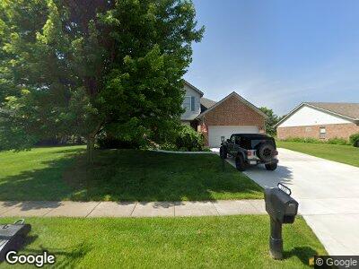
2121 Sulky Trail Beavercreek Township, OH 45434
Estimated Value: $388,287 - $443,000
4
Beds
2
Baths
2,348
Sq Ft
$176/Sq Ft
Est. Value
About This Home
This home is located at 2121 Sulky Trail, Beavercreek Township, OH 45434 and is currently estimated at $413,072, approximately $175 per square foot. 2121 Sulky Trail is a home located in Greene County with nearby schools including Trebein Elementary School, Jacob Coy Middle School, and Beavercreek High School.
Ownership History
Date
Name
Owned For
Owner Type
Purchase Details
Closed on
Oct 1, 2013
Sold by
Laporte James La and Porte James E
Bought by
Streck Kenneth G and Streck Julie E
Current Estimated Value
Home Financials for this Owner
Home Financials are based on the most recent Mortgage that was taken out on this home.
Original Mortgage
$203,300
Outstanding Balance
$155,371
Interest Rate
4.56%
Mortgage Type
New Conventional
Estimated Equity
$257,701
Purchase Details
Closed on
Aug 1, 2000
Sold by
M L Huddleston Construction Company Inc
Bought by
Laporte James and Laporte James E
Home Financials for this Owner
Home Financials are based on the most recent Mortgage that was taken out on this home.
Original Mortgage
$162,000
Interest Rate
8.24%
Create a Home Valuation Report for This Property
The Home Valuation Report is an in-depth analysis detailing your home's value as well as a comparison with similar homes in the area
Home Values in the Area
Average Home Value in this Area
Purchase History
| Date | Buyer | Sale Price | Title Company |
|---|---|---|---|
| Streck Kenneth G | $214,000 | None Available | |
| Laporte James | $190,000 | -- | |
| M L Huddleston Construction Inc | -- | -- |
Source: Public Records
Mortgage History
| Date | Status | Borrower | Loan Amount |
|---|---|---|---|
| Open | Streck Kenneth G | $203,300 | |
| Closed | Laporte James | $141,606 | |
| Closed | Laporte Jim | $167,000 | |
| Closed | Laporte Jim | $60,000 | |
| Closed | Laporte James | $163,200 | |
| Closed | Laporte James | $162,000 |
Source: Public Records
Tax History Compared to Growth
Tax History
| Year | Tax Paid | Tax Assessment Tax Assessment Total Assessment is a certain percentage of the fair market value that is determined by local assessors to be the total taxable value of land and additions on the property. | Land | Improvement |
|---|---|---|---|---|
| 2024 | $6,669 | $118,580 | $24,770 | $93,810 |
| 2023 | $6,669 | $118,580 | $24,770 | $93,810 |
| 2022 | $5,961 | $92,900 | $19,820 | $73,080 |
| 2021 | $6,020 | $92,900 | $19,820 | $73,080 |
| 2020 | $6,049 | $92,900 | $19,820 | $73,080 |
| 2019 | $5,940 | $83,770 | $15,500 | $68,270 |
| 2018 | $5,178 | $83,770 | $15,500 | $68,270 |
| 2017 | $4,915 | $83,770 | $15,500 | $68,270 |
| 2016 | $4,847 | $77,390 | $15,500 | $61,890 |
| 2015 | $4,878 | $77,390 | $15,500 | $61,890 |
| 2014 | $4,764 | $77,390 | $15,500 | $61,890 |
Source: Public Records
Map
Nearby Homes
- 2331 Eastwind Dr
- 1264 Freedom Point
- 1401 Meadow Moor Dr
- 2495 Kewanna Ln
- 2474 Coldsprings Dr
- 2168 Bassett Ct
- 2287 S Ridge Ct
- 1481 Edenwood Dr
- 1251 Lomeda Ln
- 2564 Etiwanda Dr
- 2080 Amys Ridge Ct E
- 2003 E Schmidt Dr
- 1135 Lomeda Ln
- 1059 Meadow Dr
- 1941 Schmidt Dr E
- 1363 Prestonwood Ct S
- 1156 Westover Rd
- 2282 Whitey Marshall Dr
- 895 Alpha Rd
- 1597 Windham Ln