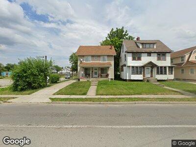
2148 Upton Ave Toledo, OH 43607
Ottawa NeighborhoodEstimated Value: $78,064 - $91,000
3
Beds
1
Bath
1,583
Sq Ft
$53/Sq Ft
Est. Value
About This Home
This home is located at 2148 Upton Ave, Toledo, OH 43607 and is currently estimated at $83,266, approximately $52 per square foot. 2148 Upton Ave is a home located in Lucas County with nearby schools including Jesup W. Scott High School, Explorers Academy, and GESU Catholic School.
Ownership History
Date
Name
Owned For
Owner Type
Purchase Details
Closed on
Mar 20, 2017
Sold by
Swolsky Joseph H and Swolsky Joe
Bought by
Carter Delano
Current Estimated Value
Purchase Details
Closed on
Oct 31, 2016
Sold by
Abron Carolyn and Abron Carolyn J
Bought by
Swolsky Joe
Purchase Details
Closed on
Jan 16, 1998
Sold by
Pappas Sharron K
Bought by
Abron Carolyn
Home Financials for this Owner
Home Financials are based on the most recent Mortgage that was taken out on this home.
Original Mortgage
$10,000
Interest Rate
6.99%
Mortgage Type
Seller Take Back
Create a Home Valuation Report for This Property
The Home Valuation Report is an in-depth analysis detailing your home's value as well as a comparison with similar homes in the area
Home Values in the Area
Average Home Value in this Area
Purchase History
| Date | Buyer | Sale Price | Title Company |
|---|---|---|---|
| Carter Delano | $15,000 | None Available | |
| Swolsky Joe | $15,000 | None Available | |
| Abron Carolyn | $11,000 | -- |
Source: Public Records
Mortgage History
| Date | Status | Borrower | Loan Amount |
|---|---|---|---|
| Previous Owner | Abron Carolyn | $24,735 | |
| Previous Owner | Abron Carolyn | $35,750 | |
| Previous Owner | Abron Carolyn | $10,000 |
Source: Public Records
Tax History Compared to Growth
Tax History
| Year | Tax Paid | Tax Assessment Tax Assessment Total Assessment is a certain percentage of the fair market value that is determined by local assessors to be the total taxable value of land and additions on the property. | Land | Improvement |
|---|---|---|---|---|
| 2024 | $926 | $13,020 | $2,030 | $10,990 |
| 2023 | $918 | $13,125 | $1,575 | $11,550 |
| 2022 | $922 | $13,125 | $1,575 | $11,550 |
| 2021 | $941 | $13,125 | $1,575 | $11,550 |
| 2020 | $986 | $12,110 | $1,505 | $10,605 |
| 2019 | $956 | $12,110 | $1,505 | $10,605 |
| 2018 | $921 | $12,110 | $1,505 | $10,605 |
| 2017 | $874 | $10,360 | $1,610 | $8,750 |
| 2016 | $1,366 | $29,600 | $4,600 | $25,000 |
| 2015 | $878 | $29,600 | $4,600 | $25,000 |
| 2014 | $1,004 | $10,360 | $1,610 | $8,750 |
| 2013 | $670 | $10,360 | $1,610 | $8,750 |
Source: Public Records
Map
Nearby Homes
- 2109 Calumet Ave
- 1719 W Bancroft St
- 2005 Potomac Dr
- 1717 Freeman St
- 2004 Calumet Ave
- 2009 Miles Ave
- 1816 Joffre Ave
- 1944 Parkside Blvd
- 1708 Cone St
- 1732 Calumet Ave
- 2000 Oakwood Ave
- 1839 Norwood Ave
- 2139 Evansdale Ave
- 1316 Shenandoah Rd
- 1615 S Cove Blvd
- 3720 Monroe St
- 1331 Grand Ave
- 1319 Lane Ave
- 1636 Woodland Ave
- 1735 Perth St