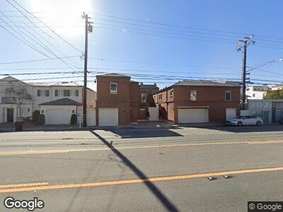
21532 Pacific Coast Hwy Malibu, CA 90265
Carbon Beach NeighborhoodEstimated Value: $5,236,000 - $8,529,852
7
Beds
9
Baths
8,195
Sq Ft
$841/Sq Ft
Est. Value
About This Home
This home is located at 21532 Pacific Coast Hwy, Malibu, CA 90265 and is currently estimated at $6,891,951, approximately $840 per square foot. 21532 Pacific Coast Hwy is a home located in Los Angeles County with nearby schools including Webster Elementary School, Malibu Middle School, and Malibu High School.
Ownership History
Date
Name
Owned For
Owner Type
Purchase Details
Closed on
Jul 16, 1997
Sold by
Fields Bertram and Chapman Robert S
Bought by
Spelling Aaron and Spelling Carole Gene
Current Estimated Value
Purchase Details
Closed on
Nov 21, 1995
Sold by
Leeds Gary M and Leeds Nita L
Bought by
Fields Bertram and Chapman Robert S
Create a Home Valuation Report for This Property
The Home Valuation Report is an in-depth analysis detailing your home's value as well as a comparison with similar homes in the area
Home Values in the Area
Average Home Value in this Area
Purchase History
| Date | Buyer | Sale Price | Title Company |
|---|---|---|---|
| Spelling Aaron | -- | First American | |
| Fields Bertram | -- | First American Title Co |
Source: Public Records
Mortgage History
| Date | Status | Borrower | Loan Amount |
|---|---|---|---|
| Open | Cs Trust | $9,723,870 | |
| Closed | Spelling Candy | $11,040,000 |
Source: Public Records
Tax History Compared to Growth
Tax History
| Year | Tax Paid | Tax Assessment Tax Assessment Total Assessment is a certain percentage of the fair market value that is determined by local assessors to be the total taxable value of land and additions on the property. | Land | Improvement |
|---|---|---|---|---|
| 2024 | $47,247 | $3,986,685 | $2,593,741 | $1,392,944 |
| 2023 | $46,315 | $3,908,516 | $2,542,884 | $1,365,632 |
| 2022 | $45,724 | $3,831,879 | $2,493,024 | $1,338,855 |
| 2021 | $44,675 | $3,756,745 | $2,444,142 | $1,312,603 |
| 2019 | $43,812 | $3,645,320 | $2,371,649 | $1,273,671 |
| 2018 | $41,561 | $3,573,845 | $2,325,147 | $1,248,698 |
| 2016 | $40,000 | $3,435,069 | $2,234,859 | $1,200,210 |
| 2015 | $39,468 | $3,383,472 | $2,201,290 | $1,182,182 |
| 2014 | $38,877 | $3,317,195 | $2,158,170 | $1,159,025 |
Source: Public Records
Map
Nearby Homes
- 21540 Pacific Coast Hwy
- 21558 Pacific Coast Hwy
- 21488 Calle Del Barco
- 21415 Rambla Vista
- 21471 Calle Del Barco
- 3851 Rambla Orienta
- 3833 Rambla Pacifico
- 3945 Las Flores Canyon Rd
- 3096 Sumac Ridge Rd
- 3625 Las Flores Canyon Rd
- 0 Carbon Unit SR24230012
- 3079 Rambla Pacifico
- 3045 Rambla Pacifico
- 22065 Pacific Coast Hwy Unit 3
- 22065 Pacific Coast Hwy Unit 2
- 21016 Pacific Coast Hwy
- 22102 Pacific Coast Hwy
- 22105 Carbon Mesa Rd
- 22202 Pacific Coast Hwy
- 20842 Pacific Coast Hwy
