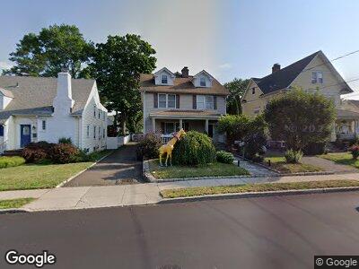
22 Union St Stamford, CT 06906
Glenbrook NeighborhoodEstimated Value: $854,000 - $1,362,326
3
Beds
5
Baths
1,700
Sq Ft
$703/Sq Ft
Est. Value
About This Home
This home is located at 22 Union St, Stamford, CT 06906 and is currently estimated at $1,194,332, approximately $702 per square foot. 22 Union St is a home located in Fairfield County with nearby schools including Julia A. Stark Elementary School, Dolan School, and Stamford High School.
Ownership History
Date
Name
Owned For
Owner Type
Purchase Details
Closed on
Aug 28, 2024
Sold by
Teal Wendy Est and Teal
Bought by
Teal Wendy
Current Estimated Value
Purchase Details
Closed on
Jun 4, 2008
Sold by
Zarovniy Sergei and Zarovniy Natalia
Bought by
Teal Winnie B
Purchase Details
Closed on
Feb 5, 2004
Sold by
Finn Michael and Finn Ellen
Bought by
Zarovniy Sergei and Zarovniy Natalia
Home Financials for this Owner
Home Financials are based on the most recent Mortgage that was taken out on this home.
Original Mortgage
$320,000
Interest Rate
4.87%
Mortgage Type
Purchase Money Mortgage
Create a Home Valuation Report for This Property
The Home Valuation Report is an in-depth analysis detailing your home's value as well as a comparison with similar homes in the area
Home Values in the Area
Average Home Value in this Area
Purchase History
| Date | Buyer | Sale Price | Title Company |
|---|---|---|---|
| Teal Wendy | -- | None Available | |
| Teal Wendy | -- | None Available | |
| Teal Winnie B | $1,100,000 | -- | |
| Teal Winnie B | $1,100,000 | -- | |
| Zarovniy Sergei | $425,000 | -- | |
| Zarovniy Sergei | $425,000 | -- |
Source: Public Records
Mortgage History
| Date | Status | Borrower | Loan Amount |
|---|---|---|---|
| Previous Owner | Teal Wendy | $10,541 | |
| Previous Owner | Teal Winnie | $8,590 | |
| Previous Owner | Teal Winnie B | $52,704 | |
| Previous Owner | Teal Winnie | $228,937 | |
| Previous Owner | Zarovniy Sergei | $320,000 |
Source: Public Records
Tax History Compared to Growth
Tax History
| Year | Tax Paid | Tax Assessment Tax Assessment Total Assessment is a certain percentage of the fair market value that is determined by local assessors to be the total taxable value of land and additions on the property. | Land | Improvement |
|---|---|---|---|---|
| 2024 | $17,399 | $751,900 | $205,620 | $546,280 |
| 2023 | $18,692 | $751,900 | $205,620 | $546,280 |
| 2022 | $15,688 | $586,670 | $157,850 | $428,820 |
| 2021 | $15,517 | $586,670 | $157,850 | $428,820 |
| 2020 | $15,118 | $586,670 | $157,850 | $428,820 |
| 2019 | $15,118 | $586,670 | $157,850 | $428,820 |
| 2018 | $14,561 | $586,670 | $157,850 | $428,820 |
| 2017 | $11,596 | $446,010 | $132,590 | $313,420 |
| 2016 | $11,271 | $446,010 | $132,590 | $313,420 |
| 2015 | $10,976 | $446,010 | $132,590 | $313,420 |
| 2014 | $10,611 | $446,010 | $132,590 | $313,420 |
Source: Public Records
Map
Nearby Homes
- 409 Hope St Unit G
- 426 Courtland Ave Unit 1
- 18 Parker Ave
- 439 Glenbrook Rd Unit A
- 86 Toms Rd
- 0 Toms Rd Unit LOT 56
- 49 Plymouth Rd
- 377 Glenbrook Rd Unit 15
- 88 Maple Tree Ave Unit H
- 15 Phillips Ln
- 5 Radio Place Unit 5
- 103 Rock Spring Rd Unit 3
- 147 Holmes Ave
- 71 Belltown Rd
- 257 Culloden Rd
- 22 Radio Place Unit 10
- 150 Hope St Unit 16
- 150 Hope St Unit 8
- 24 Radio Place Unit 24
- 321 Glenbrook Rd