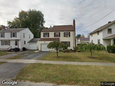
221 Merchant Ave Marion, OH 43302
Estimated Value: $152,000 - $199,000
3
Beds
2
Baths
1,620
Sq Ft
$108/Sq Ft
Est. Value
About This Home
This home is located at 221 Merchant Ave, Marion, OH 43302 and is currently estimated at $174,618, approximately $107 per square foot. 221 Merchant Ave is a home located in Marion County with nearby schools including George Washington Elementary School, Ulysses S. Grant Middle School, and Harding High School.
Ownership History
Date
Name
Owned For
Owner Type
Purchase Details
Closed on
Jul 18, 2023
Sold by
Wilson James C and Wilson Kimberly A
Bought by
Al King Hong Llc
Current Estimated Value
Purchase Details
Closed on
Aug 21, 2020
Sold by
Johnson Mary J
Bought by
Wilson James C and Wilson Kimberly A
Home Financials for this Owner
Home Financials are based on the most recent Mortgage that was taken out on this home.
Original Mortgage
$103,437
Interest Rate
2.9%
Mortgage Type
FHA
Purchase Details
Closed on
Feb 25, 1999
Bought by
Johnson Mary J
Create a Home Valuation Report for This Property
The Home Valuation Report is an in-depth analysis detailing your home's value as well as a comparison with similar homes in the area
Home Values in the Area
Average Home Value in this Area
Purchase History
| Date | Buyer | Sale Price | Title Company |
|---|---|---|---|
| Al King Hong Llc | -- | None Listed On Document | |
| Wilson James C | $106,000 | Ct | |
| Johnson Mary J | -- | -- |
Source: Public Records
Mortgage History
| Date | Status | Borrower | Loan Amount |
|---|---|---|---|
| Previous Owner | Wilson Kimberly A | $103,097 | |
| Previous Owner | Wilson James C | $103,437 | |
| Previous Owner | Johnson Mary J | $96,000 |
Source: Public Records
Tax History Compared to Growth
Tax History
| Year | Tax Paid | Tax Assessment Tax Assessment Total Assessment is a certain percentage of the fair market value that is determined by local assessors to be the total taxable value of land and additions on the property. | Land | Improvement |
|---|---|---|---|---|
| 2024 | $1,660 | $43,330 | $5,550 | $37,780 |
| 2023 | $1,660 | $43,330 | $5,550 | $37,780 |
| 2022 | $1,503 | $43,330 | $5,550 | $37,780 |
| 2021 | $1,280 | $33,230 | $4,820 | $28,410 |
| 2020 | $1,316 | $33,230 | $4,820 | $28,410 |
| 2019 | $1,315 | $33,230 | $4,820 | $28,410 |
| 2018 | $1,178 | $29,780 | $4,820 | $24,960 |
| 2017 | $1,194 | $29,780 | $4,820 | $24,960 |
| 2016 | $1,189 | $29,780 | $4,820 | $24,960 |
| 2015 | $1,187 | $29,080 | $4,590 | $24,490 |
| 2014 | $1,186 | $29,080 | $4,590 | $24,490 |
| 2012 | $1,265 | $30,750 | $5,570 | $25,180 |
Source: Public Records
Map
Nearby Homes
- 1071 E Church St
- 229 Clover Ave
- 142 Pennsylvania Ave
- 300 Forest Lawn Blvd
- 223 Forest Lawn Blvd
- 881 E Church St
- 796 Grove St
- 448 Uhler Ave
- 140 S Grand Ave
- 320 Franconia Ave
- 165 Lawrence Ave
- 191 Lawrence Ave
- 263 Hane Ave
- 774 Mount Vernon Ave
- 783 Mount Vernon Ave
- 0 Denning Ave
- 137 Carhart St
- 645 Wilson Ave
- 1294 Woodside Dr
- 285 Summit St