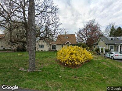
2221 Bethel Rd Lansdale, PA 19446
Worcester Township NeighborhoodEstimated Value: $436,000 - $618,000
2
Beds
3
Baths
2,379
Sq Ft
$224/Sq Ft
Est. Value
About This Home
This home is located at 2221 Bethel Rd, Lansdale, PA 19446 and is currently estimated at $532,795, approximately $223 per square foot. 2221 Bethel Rd is a home with nearby schools including Worcester El School, Skyview Upper Elementary School, and Arcola Intermediate School.
Ownership History
Date
Name
Owned For
Owner Type
Purchase Details
Closed on
Sep 6, 2012
Bought by
Moxey Gail F
Current Estimated Value
Home Financials for this Owner
Home Financials are based on the most recent Mortgage that was taken out on this home.
Original Mortgage
$50,000
Interest Rate
3.5%
Mortgage Type
Credit Line Revolving
Purchase Details
Closed on
Jan 14, 1994
Sold by
Bucko Christopher P and Mangan Irene D
Bought by
Rieger Daniel J and Rieger Marquetta L
Create a Home Valuation Report for This Property
The Home Valuation Report is an in-depth analysis detailing your home's value as well as a comparison with similar homes in the area
Home Values in the Area
Average Home Value in this Area
Purchase History
| Date | Buyer | Sale Price | Title Company |
|---|---|---|---|
| Moxey Gail F | -- | -- | |
| Rieger Daniel J | $127,500 | First American Title Ins Co |
Source: Public Records
Mortgage History
| Date | Status | Borrower | Loan Amount |
|---|---|---|---|
| Open | Moxey Gail F | $50,000 | |
| Closed | Moxey Gail F | $50,000 | |
| Previous Owner | Grebb Gail F | $25,000 | |
| Previous Owner | Moxey Gail F | $75,000 | |
| Previous Owner | Grebb Gail F | $0 |
Source: Public Records
Tax History Compared to Growth
Tax History
| Year | Tax Paid | Tax Assessment Tax Assessment Total Assessment is a certain percentage of the fair market value that is determined by local assessors to be the total taxable value of land and additions on the property. | Land | Improvement |
|---|---|---|---|---|
| 2024 | $6,355 | $167,810 | -- | -- |
| 2023 | $6,096 | $167,810 | $0 | $0 |
| 2022 | $5,979 | $167,810 | $0 | $0 |
| 2021 | $5,861 | $167,810 | $0 | $0 |
| 2020 | $5,752 | $167,810 | $0 | $0 |
| 2019 | $5,696 | $167,810 | $0 | $0 |
| 2018 | $653 | $167,810 | $0 | $0 |
| 2017 | $5,477 | $167,810 | $0 | $0 |
| 2016 | $5,411 | $164,170 | $81,450 | $82,720 |
| 2015 | $5,105 | $164,170 | $81,450 | $82,720 |
| 2014 | $5,105 | $164,170 | $81,450 | $82,720 |
Source: Public Records
Map
Nearby Homes
- 1304 Oak Cir
- 2564 Morris Rd
- 106 Mahogany Way
- 137 Mahogany Way
- 2095 Deep Meadow Ln
- 278 Goldenrod Dr
- 432 Primrose Dr
- 261 Goldenrod Dr
- 389 Primrose Dr
- 404 Tamworth Ct
- 5 Capri
- Lot 7 2513 Serven Ct
- 15 Finley Ct
- 2 Capri Ln Unit KINSLEY
- 377 Dewsbury Place
- 649 Park Rd Unit 51
- 702 Broadmoor Dr
- 687 Garfield Ave
- 606 Shepard Dr
- 1902 Linden Way