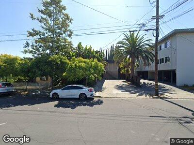
228 Samson St Redwood City, CA 94063
Centennial NeighborhoodEstimated Value: $1,447,000 - $1,902,000
5
Beds
5
Baths
2,900
Sq Ft
$567/Sq Ft
Est. Value
About This Home
This home is located at 228 Samson St, Redwood City, CA 94063 and is currently estimated at $1,644,667, approximately $567 per square foot. 228 Samson St is a home located in San Mateo County with nearby schools including Clifford School, John F. Kennedy Middle School, and Sequoia High School.
Ownership History
Date
Name
Owned For
Owner Type
Purchase Details
Closed on
Dec 23, 2014
Sold by
Cotla Daniel Wayne
Bought by
Ostertag Susan
Current Estimated Value
Purchase Details
Closed on
Jan 7, 2009
Sold by
Ostertag Susan
Bought by
Ostertag Susan
Purchase Details
Closed on
Jul 24, 2004
Sold by
Smith William H
Bought by
Smith William H
Create a Home Valuation Report for This Property
The Home Valuation Report is an in-depth analysis detailing your home's value as well as a comparison with similar homes in the area
Home Values in the Area
Average Home Value in this Area
Purchase History
| Date | Buyer | Sale Price | Title Company |
|---|---|---|---|
| Ostertag Susan | $12,000 | None Available | |
| Cotla Daniel Wayne | -- | None Available | |
| Ostertag Susan | -- | None Available | |
| Smith William H | -- | -- |
Source: Public Records
Tax History Compared to Growth
Tax History
| Year | Tax Paid | Tax Assessment Tax Assessment Total Assessment is a certain percentage of the fair market value that is determined by local assessors to be the total taxable value of land and additions on the property. | Land | Improvement |
|---|---|---|---|---|
| 2023 | $4,709 | $406,211 | $121,850 | $284,361 |
| 2022 | $4,426 | $398,247 | $119,461 | $278,786 |
| 2021 | $4,383 | $390,439 | $117,119 | $273,320 |
| 2020 | $4,326 | $386,437 | $115,919 | $270,518 |
| 2019 | $4,310 | $378,861 | $113,647 | $265,214 |
| 2018 | $4,156 | $371,433 | $111,419 | $260,014 |
| 2017 | $4,156 | $364,151 | $109,235 | $254,916 |
| 2016 | $4,070 | $357,012 | $107,094 | $249,918 |
| 2015 | $3,921 | $351,650 | $105,486 | $246,164 |
| 2014 | $3,847 | $344,762 | $103,420 | $241,342 |
Source: Public Records
Map
Nearby Homes
- 1418 Lenolt St
- 308 B St
- 1140 Whipple Ave Unit 22
- 1518 Stafford St
- 30 Clinton St
- 1434 Jefferson Ave
- 1090 Main St Unit 401
- 449 Grand St
- 636 Bair Island Rd Unit 301
- 720 Elm St
- 642 Bair Island Rd Unit 1002
- 315 King St
- 736 Cedar St
- 622 Hilton St Unit 3
- 827 Chestnut St
- 1534 White Oak Way
- 635 Park Ave
- 938 Fulton St
- 153 Nevada St
- 818 Vera Ave
